Villeneuve-sur-Lot
| miejscowość i gmina | |||
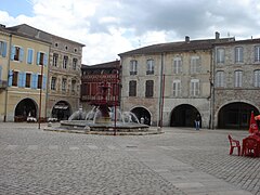
 Plac z fontanną w Villeneuve-sur-Lot | |||
| |||
| Państwo | |||
|---|---|---|---|
| Region | |||
| Departament | |||
| Okręg | |||
| Kod INSEE | 47323 | ||
| Powierzchnia | 81,36 km² | ||
| Wysokość | 53 m n.p.m.[1] | ||
| Populacja (2013) • liczba ludności |
| ||
| Kod pocztowy | 47300 | ||
| Portal | |||
Villeneuve-sur-Lot – miejscowość i gmina we Francji, w regionie Nowa Akwitania, w departamencie Lot i Garonna. W 2013 roku populacja gminy wynosiła 24 481 mieszkańców[2]. Przez teren gminy przepływa rzeka Lot[3].
Gmina Villeneuve-sur-Lot sąsiaduje z Bias, Pujols i La Sauvetat-sur-Lède. Miejscowość znajduje się w odległości 24 km na północny wschód od Agen – jednego z większych miast w pobliżu[1].
Współpraca
 Ávila, Hiszpania
 Bouaké, Wybrzeże Kości Słoniowej
 Neustadt bei Coburg, Niemcy
 San Donà di Piave, Włochy
 Troon, Szkocja
Przypisy
- ↑ a b Ville de Villeneuve-sur-Lot. Annuaire-Mairie.fr. [dostęp 2017-06-26]. (fr.).
- ↑ Populations légales 2013. INSEE. [dostęp 2017-06-26]. (fr.).
- ↑ Rivière Le Lot. Annuaire-Mairie.fr. [dostęp 2017-06-26]. (fr.).
Media użyte na tej stronie
Autor: Superbenjamin, Licencja: CC BY-SA 4.0
Blank administrative map of France for geo-location purpose, with regions and departements distinguished. Approximate scale : 1:3,000,000
Autor: Flappiefh, Licencja: CC BY-SA 4.0
Carte administrative vierge de la région Aquitaine-Limousin-Poitou-Charentes, France, destinée à la géolocalisation.
Autor: Pedro A. Gracia Fajardo, escudo de Manual de Imagen Institucional de la Administración General del Estado, Licencja: CC0
Flaga Hiszpanii
Flag of the Ivory Coast, written by Jon Harald Søby, modified by Zscout370. The colors match to what is reported at http://fotw.vexillum.com/flags/ci.html.
Autor: unknown, Licencja: CC BY-SA 4.0
Place et fontaine de Villeneuve-sur-Lot


