Villeneuvette
| miejscowość i gmina | |
 Villeneuvette (2007) | |
| Państwo | |
|---|---|
| Region | |
| Departament | |
| Okręg | |
| Kod INSEE | 34338 |
| Powierzchnia | 3,19 km² |
| Populacja (1990) • liczba ludności |
|
| • gęstość | 26 os./km² |
| Kod pocztowy | 34800 |
| Portal | |
Villeneuvette – miejscowość i gmina we Francji, w regionie Oksytania, w departamencie Hérault.
Według danych na rok 1990 gminę zamieszkiwały 83 osoby, a gęstość zaludnienia wynosiła 26 osób/km² (wśród 1545 gmin Langwedocji-Roussillon Villeneuvette plasuje się na 818. miejscu pod względem liczby ludności, natomiast pod względem powierzchni na miejscu 1082.).
Populacja
Galeria
Bibliografia
- Francuski urząd statystyczny. (fr.).
Media użyte na tej stronie
Autor: Flappiefh, Licencja: CC BY-SA 4.0
Blank administrative map of the department of Hérault, France, for geo-location purpose.
Autor: Superbenjamin, Licencja: CC BY-SA 4.0
Blank administrative map of France for geo-location purpose, with regions and departements distinguished. Approximate scale : 1:3,000,000
Autor: Flappiefh, Licencja: CC BY-SA 4.0
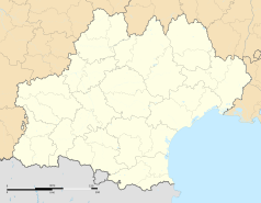
Carte administrative vierge de la région Languedoc-Roussillon-Midi-Pyrénées, France, destinée à la géolocalisation.
Autor: Fagairolles 34, Licencja: CC BY-SA 4.0
Villeneuvette (Hérault) - Grand-rue.
Autor: Fagairolles 34, Licencja: CC BY-SA 4.0
Església parroquial de Nostra Senyora de l'Assumpció de la Fatura (Llenguadoc-Rosselló)
Autor: Christian Ferrer, Licencja: CC BY-SA 3.0
The "Pont de l'Amour" (Bridge of Love) is the part of an aqueduct which overhang the stream "La Dourbie". Aqueduct which date from the second half of the XVIIth century and used to convey water from the neighboring commune of Mourèze. Villeneuvette, Hérault, France.
Autor: Fagairolles 34, Licencja: CC BY-SA 4.0
Villeneuvette (Hérault) - mairie.
Autor: Michiel1972, Licencja: CC BY-SA 3.0
Population - Municipality code 34338.svg
Population Census 1962-2008


