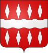
Viroinval
 | |||||
| Państwo | |||||
|---|---|---|---|---|---|
| Region | Waloński | ||||
| Prowincja | Namur | ||||
| Populacja • liczba ludności | 5731 | ||||
| Nr kierunkowy | 060 | ||||
| Kod pocztowy | 5670 | ||||
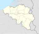
Położenie na mapie Belgii (c) Karte: NordNordWest, Lizenz: Creative Commons by-sa-3.0 de | |||||
| 50,057°N 4,621°E/50,056700 4,620600 | |||||
| Strona internetowa | |||||
Viroinval – miejscowość i gmina w Belgii, w prowincji Namur. W 2018 roku liczyła 5731 mieszkańców.
Media użyte na tej stronie
Belgium adm location map.svg
(c) Karte: NordNordWest, Lizenz: Creative Commons by-sa-3.0 de
Location map of Belgium
(c) Karte: NordNordWest, Lizenz: Creative Commons by-sa-3.0 de
Location map of Belgium
Nismes JPG02.jpg
Autor: Jean-Pol GRANDMONT, Licencja: CC BY 3.0
Nismes (Belgium), the castle, the post office and the bridge on the Eau Noire river.
Autor: Jean-Pol GRANDMONT, Licencja: CC BY 3.0
Nismes (Belgium), the castle, the post office and the bridge on the Eau Noire river.
Flag of Viroinval.svg
Flag of the Belgian municipality Viroinval
Flag of the Belgian municipality Viroinval


