Vlastislav
| gmina | |||||
 | |||||
| Państwo | |||||
|---|---|---|---|---|---|
| Kraj | |||||
| Powiat | |||||
| Kod statystyczny | CZ0423 565873 | ||||
| Populacja (2022) • liczba ludności |
| ||||
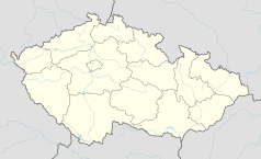
Położenie na mapie Czech (c) Karte: NordNordWest, Lizenz: Creative Commons by-sa-3.0 de | |||||
| 50°29′49,3837″N 13°57′19,8921″E/50,497051 13,955526 | |||||
| Portal | |||||
Vlastislav – miejscowość i gmina (obec) w Czechach, w kraju usteckim, w powiecie Litomierzyce. W 2022 roku liczyła 176 mieszkańców[1].
Przypisy
- ↑ Počet obyvatel v obcích České republiky k 1. 1. 2022. Český statistický úřad. [dostęp 2022-12-17]. (cz.).
Linki zewnętrzne
Media użyte na tej stronie
Czech Republic adm location map.svg
(c) Karte: NordNordWest, Lizenz: Creative Commons by-sa-3.0 de
Location map of the Czech Republic
(c) Karte: NordNordWest, Lizenz: Creative Commons by-sa-3.0 de
Location map of the Czech Republic
Plesivec 477m Ceske stredohori Vlastislav LT CZ view towards E 172.jpg
View from summit of Plešivec (477 m) in České středohoří Mts. towards east. In the foreground hamlet of Chrastná with wide valley of the Modla stream beyond. In the valley on the left village of Vlastislav with castle tower and chateau visible. On the right side there lies village of Teplá. Hills on the horizon left to right: Boreč (446 m), Sutomský vrch (505 m), at centre Jezerka (487 m) and Košťál (aka Košťálov, 481 m) with another castle ruin.
View from summit of Plešivec (477 m) in České středohoří Mts. towards east. In the foreground hamlet of Chrastná with wide valley of the Modla stream beyond. In the valley on the left village of Vlastislav with castle tower and chateau visible. On the right side there lies village of Teplá. Hills on the horizon left to right: Boreč (446 m), Sutomský vrch (505 m), at centre Jezerka (487 m) and Košťál (aka Košťálov, 481 m) with another castle ruin.
Vlastislav CZ CoA.jpg
Municipal coat of arms of Vlastislav village, Litoměřice District, Czech Republic.
Municipal coat of arms of Vlastislav village, Litoměřice District, Czech Republic.


