Vogelkarspitze
| ||
 | ||
| Państwo | ||
| Położenie | Scharnitz, Mittenwald | |
| Pasmo | Karwendel | |
| Wysokość | 2522 m n.p.m. | |
| Pierwsze wejście | 4 lipca 1870 Hermann von Barth | |
Vogelkarspitze – szczyt w paśmie Karwendel, w Alpach Wschodnich. Leży na granicy między Austrią (Tyrol), a Niemcami (Bawaria). Sąsiaduje z Östliche Karwendelspitze i Grabenkarspitze.
Pierwszego wejścia, 4 lipca 1870 r. dokonał Hermann von Barth.
Bibliografia
Media użyte na tej stronie
Black up-pointing triangle ▲, U+25B2 from Unicode-Block Geometric Shapes (25A0–25FF)
Autor: Rosso Robot, Licencja: CC BY-SA 3.0
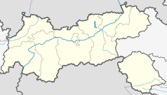
Location map of The Tyrol
Equirectangular projection. Geographic limits of the map:
- N: 47.75317° N
- S: 46.64119° N
- W: 10.08236° E
- E: 12.98961° E
Autor: Uwe Dedering, Licencja: CC BY-SA 3.0
Location map of Austria
Equirectangular projection, N/S stretching 150 %. Geographic limits of the map:
- N: 49.2° N
- S: 46.3° N
- W: 9.4° E
- E: 17.2° E
Autor: Luidger, Licencja: CC-BY-SA-3.0
Die Nördliche Karwendelkette von der Vogelkarspitze, der Östlichen Karwendelspitze bis zur Grabenkarspitze. Weg im Karwendeltal zur Hochalm und zum Karwendelhaus (nicht sichtbar). Gjaidsteig im Latschengürtel zur Hochalm. Pfad hinauf zum Hochalmkreuz. Ansicht von Süden (von der Mittleren Ödkarspitze).


