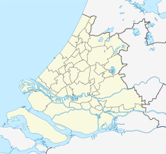
Voorschoten
 | |||||
| Państwo | |||||
|---|---|---|---|---|---|
| Prowincja | |||||
| Burmistrz | Jeroen Staatsen (2014)[1] | ||||
| Powierzchnia | 11,56 km² | ||||
| Populacja (2004) • liczba ludności | 22 505 | ||||
| Kod pocztowy | 2250–2254 | ||||
| Strona internetowa | |||||
Voorschoten – gmina w zachodniej Holandii, w prowincji Holandia Południowa. Wchodzi w skład konurbacji Randstad.
Jest gminą partnerską dla litewskich Druskienik[2].
Przypisy
- ↑ voorschoten.nl: Bestuur en Organisatie (niderl.). [dostęp 2014-07-12]. [zarchiwizowane z tego adresu (2013-07-14)].
- ↑ druskininkai.lt - lista miast partnerskich Druskienik
Media użyte na tej stronie
Autor: Evert r, Licencja: CC BY-SA 3.0
Starrenburg I at the other side of the Vliet (Voorschoten, NL)
(c) Tilanus, CC-BY-SA-3.0
Kloosterkapel in Voorschoten, South Holland, the Netherlands
Flag of Voorschoten, in South Holland province, the Netherlands.
Autor: Erik Frohne, Licencja: CC BY-SA 3.0
Location map of province South Holland in the Netherlands
Equirectangular projection, N/S stretching 162 %. Geographic limits of the map:
- N: 52.40° N
- S: 51.60° N
- W: 3.80° E
- E: 5.20° E
Coat of arms of the municipality Voorschoten


