Voutezac
| gmina | |||
 Voutezac, 2009 | |||
| |||
| Państwo | |||
|---|---|---|---|
| Region | |||
| Departament | |||
| Okręg | |||
| Kod INSEE | 19288 | ||
| Powierzchnia | 22,3 km² | ||
| Populacja (1990) • liczba ludności |
| ||
| • gęstość | 46 os./km² | ||
| Kod pocztowy | 19130 | ||
| Strona internetowa | |||
| Portal | |||
Voutezac – miejscowość i gmina we Francji, w regionie Nowa Akwitania, w departamencie Corrèze.
Według danych na rok 1990 gminę zamieszkiwało 1026 osób, a gęstość zaludnienia wynosiła 46 osób/km² (wśród 747 gmin Limousin Voutezac plasuje się na 126. miejscu pod względem liczby ludności, natomiast pod względem powierzchni na miejscu 296.).
15 grudnia 1908 w tunelu kolejowym „de Pouch” pomiędzy stacjami Allassac i Estivaux miała miejsce katastrofa. Zderzeniu uległ pociąg osobowy z pociągiem towarowym[1][2][3][4]. Zginęło wówczas 15 osób.
Populacja
Przypisy
- ↑ Terrible accident de chemin de fer. „Le Petit journal”. 16792, s. 1, 1908-12-17 (fr.).
- ↑ La catastrophe D'Estivaux. „Le Figaro”. 1908/352, s. 4, 1908-12-17 (fr.).
- ↑ L'accident du Tunnel de Pouch. „Le Petit journal”. 16794, s. 3, 1908-12-19 (fr.).
- ↑ La catastrophe D'Allassac. „Le Petit Parisien”. 11742, s. 3, 1908-12-22 (fr.).
Bibliografia
- Francuski urząd statystyczny (fr.).
Linki zewnętrzne
Media użyte na tej stronie
Autor: Superbenjamin, Licencja: CC BY-SA 4.0
Blank administrative map of France for geo-location purpose, with regions and departements distinguished. Approximate scale : 1:3,000,000
Autor: Flappiefh, Licencja: CC BY-SA 4.0
Carte administrative vierge de la région Aquitaine-Limousin-Poitou-Charentes, France, destinée à la géolocalisation.
Autor: Michiel1972, Licencja: CC BY-SA 3.0
Population - Municipality code 19288.svg
Population Census 1962-2008Autor: Flappiefh, Licencja: CC BY-SA 4.0
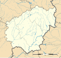
Blank administrative map of the department of Corrèze, France, for geo-location purpose.
Catastrophe du tunnel de Pouch du 15 décembre 1908 (vue de l'arrière de la machine sous le tunnel).
Autor: Jacques63, Licencja: CC BY-SA 3.0
d'argent à la fasce crénelée de gueules chargée d'un lion d'or et accompagnée en chef d'une croisette d'azur et en pointe d'une grappe de raisin de pourpre feuillée et tigée de sinople
Catastrophe du tunnel de Pouch du 15 décembre 1908 (transport d'un cadavre).
Catastrophe du tunnel de Pouch du 15 décembre 1908 (la machine).
Catastrophe du tunnel de Pouch du 15 décembre 1908 (carcasse d'un wagon).


