Vratislávka
| gmina | |||||
 | |||||
| Państwo | |||||
|---|---|---|---|---|---|
| Kraj | |||||
| Powiat | |||||
| Kraina | |||||
| Powierzchnia | 3,49 km² | ||||
| Populacja (2014) • liczba ludności |
| ||||
| Kod pocztowy | 594 51 | ||||
| Szczegółowy podział administracyjny | |||||
| Liczba obrębów ewidencyjnych | 1 | ||||
| Liczba części gminy | 1 | ||||
| Liczba gmin katastralnych | 1 | ||||
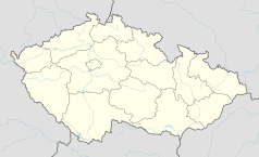
Położenie na mapie Czech (c) Karte: NordNordWest, Lizenz: Creative Commons by-sa-3.0 de | |||||
| Strona internetowa | |||||
| Portal | |||||
Vratislávka – gmina w Czechach, w powiecie Brno, w kraju południowomorawskim. 1 stycznia 2014 liczyła 88 mieszkańców[1].
Przypisy
- ↑ a b Počty obyvatel v obcích k 1. 1. 2014. www.mvcr.cz. [dostęp 2015-12-05]. (cz.).
Media użyte na tej stronie
(c) Karte: NordNordWest, Lizenz: Creative Commons by-sa-3.0 de
Location map of the Czech Republic
Flag of South Moravian Region
Coat of arms of Vratislávka, Brno-Country District, Czech Republic.
Flag of Vratislávka, Brno-venkov District, Czech Republic.
Autor: I would appreciate being notified if you use my work outside Wikimedia.
Do not copy this image illegally by ignoring the terms of the license below, as it is not in the public domain. If you would like special permission to use, license, or purchase the image please contact me to negotiate terms.
More of my work can be found in my personal gallery., Licencja: CC BY-SA 4.0Obec Vratislávka v okrese Brno-venkov. Kaple na návsi.


