Waco (Teksas)
| |||||
 | |||||
| Państwo | |||||
|---|---|---|---|---|---|
| Stan | |||||
| Data założenia | 1849[1] | ||||
| Prawa miejskie | 1856[1] | ||||
| Burmistrz | Kyle Deaver | ||||
| Populacja (2019) • liczba ludności | 139 236[2] | ||||
| Nr kierunkowy | 254 | ||||
| Kod pocztowy | 76700–76799 | ||||
| Strona internetowa | |||||
| Portal | |||||
Waco – miasto w Stanach Zjednoczonych, w stanie Teksas, nad rzeką Brazos, ośrodek administracyjny hrabstwa McLennan.
Liczba mieszkańców: 139 236 (2019)
Gospodarka
W mieście rozwinął się przemysł lotniczy, gumowy, szklarski, odzieżowy oraz spożywczy[1].
Sport
W mieście rozgrywany jest kobiecy turniej tenisowy, pod nazwą Waco Showdawn $80K , zaliczany do rangi ITF, z pulą nagród 80 000 $[3].
Osoby związane z Waco
- Jennifer Love Hewitt – amerykańska aktorka i piosenkarka, urodziła się w Waco, a wychowała w Killeen
- Leon Jaworski – amerykański prawnik polskiego pochodzenia, urodził się i wychował w Waco
- David Koresh – przywódca apokaliptycznej sekty Gałęzi Dawidowej, zginął w Waco
- Terrence Malick – reżyser (Cienka czerwona linia, Drzewo życia), urodził się w Waco
- Steve Martin – amerykański aktor, urodził się w Waco
- Kevin Reynolds – reżyser (Robin Hood – książę złodziei, Hrabia Monte Christo, Wodny świat), urodził się i wychował w Waco
- Jessie Washington – upośledzony umysłowo Afroamerykanin, ofiara głośnego linczu
Przypisy
- ↑ a b c Waco, [w:] Encyklopedia PWN [online] [dostęp 2021-08-27].
- ↑ US Census Bureau.
- ↑ Waco Tennis Showdown – A UTSA Pro Circuit Event [dostęp 2017-12-11] [zarchiwizowane z adresu 2017-12-25].
Linki zewnętrzne
Media użyte na tej stronie
Autor: Uwe Dedering, Licencja: CC BY-SA 3.0
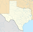
Location map of the USA (without Hawaii and Alaska).
EquiDistantConicProjection:
Central parallel:
* N: 37.0° N
Central meridian:
* E: 96.0° W
Standard parallels:
* 1: 32.0° N
* 2: 42.0° N
Made with Natural Earth. Free vector and raster map data @ naturalearthdata.com.
Formulas for x and y:
x = 50.0 + 124.03149777329222 * ((1.9694462586094064-({{{2}}}* pi / 180))
      * sin(0.6010514667026994 * ({{{3}}} + 96) * pi / 180))
y = 50.0 + 1.6155950752393982 * 124.03149777329222 * 0.02613325650382181
      - 1.6155950752393982  * 124.03149777329222 *
     (1.3236744353715044  - (1.9694462586094064-({{{2}}}* pi / 180))
      * cos(0.6010514667026994 * ({{{3}}} + 96) * pi / 180))
The flag of Navassa Island is simply the United States flag. It does not have a "local" flag or "unofficial" flag; it is an uninhabited island. The version with a profile view was based on Flags of the World and as a fictional design has no status warranting a place on any Wiki. It was made up by a random person with no connection to the island, it has never flown on the island, and it has never received any sort of recognition or validation by any authority. The person quoted on that page has no authority to bestow a flag, "unofficial" or otherwise, on the island.
Autor: Alexrk, Licencja: CC BY 3.0
Ta mapa została stworzona za pomocą GeoTools.
Autor: Aboxorocks, Licencja: CC BY-SA 3.0
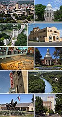
From left to right, top to bottom: Downtown Waco, McLennan County Courthouse, The Waco Suspension Bridge, Dr. Pepper Museum, Waco Mammoth Site, Baylor University's Patt Neff Hall, Waco Hippodrome, Cameron Park, The Texas Rangers Museum and Austin Avenue in Downtown
The "Flying W" logo of the City of Waco in Texas, created by city employee Carol Perry in 1985.
Autor:
- File:Flag of Waco, Texas.jpg: Seatex
- derivative work: Cookieman1.1.1
Flag of Waco, Texas


