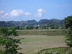
Waikabubak
 | |
| Państwo | |
|---|---|
| Prowincja | |
| Populacja (2018) • liczba ludności |
|
Waikabubak – miasto w Indonezji na wyspie Sumba w prowincji Małe Wyspy Sundajskie Wschodnie; ośrodek administracyjny kabupatenu Sumba Barat[1]; 33 tys. mieszkańców (2018)[2].
Przypisy
- ↑ Lalu Rahadian: Wisata Satu Malam di Sumba Barat (indonez.). CNN Indonesia, 2016-11-27. [dostęp 2021-02-10]. [zarchiwizowane z tego adresu (2021-02-10)].
- ↑ Badan Pusat Statistik, Jakarta, 2020.
Media użyte na tej stronie
Autor: Uwe Dedering, Licencja: CC BY-SA 3.0
Location map of Indonesia.
Equirectangular projection. Stretched by 100.0%. Geographic limits of the map:
- N: 6.5° N
- S: -11.5° N
- W: 94.5° E
- E: 141.5° E
bendera Indonesia
The coat of arms of the Indonesian province of East Nusa Tenggara, featuring a Komodo dragon (Varanus komodoensis), star, paddy and cotton stalks, the year 1958 and a harpoon.


