Washington (jezioro)
 Jezioro Washington (na pierwszym planie) i zatoka Puget Sound (w tle); pomiędzy nimi miasto Seattle. Widoczne także wyspa Mercer (na dole, z lewej) i miasto Bellevue (na dole, z prawej) | |
| Położenie | |
| Państwo | |
|---|---|
| Lokalizacja | stan Waszyngton |
| Miejscowości nadbrzeżne | Seattle, Bellevue, Kenmore, Kirkland, Lake Forest Park, Medina, Mercer Island, Renton |
| Wysokość lustra | 5 m n.p.m. |
| Morfometria | |
| Powierzchnia | 90 km² |
| Hydrologia | |
| Rzeki zasilające | Cedar, Sammamish |
 Mapa zlewiska jeziora Washington | |
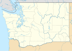
Jezioro Washington (ang. Lake Washington) – jezioro w zachodniej części amerykańskiego stanu Waszyngton w hrabstwie King, położone kilka kilometrów od wschodniego wybrzeża zatoki Puget Sound[1].
Powierzchnia jeziora wynosi 90 km²[2] (drugi pod względem wielkości naturalny zbiornik wodny na terenie stanu Waszyngton). Główne rzeki zasilające jezioro to Cedar oraz Sammamish. Odpływ wód jeziora następuje kanałem Lake Washington Ship Canal, który łączy je, poprzez jezioro Union, z zatoką Puget Sound. Otwarcie kanału w 1916 roku spowodowało spadek wysokości lustra jezioro o 3 m, do obecnego poziomu 5 m n.p.m, a w rezultacie wyschnięcie wypływającej z jeziora rzeki Black[1].
Wybrzeże jeziora jest silnie zurbanizowane[1]. Położone są nad nim miasta Seattle, Bellevue, Kenmore, Kirkland, Lake Forest Park, Medina, Mercer Island (położone na wyspie o tej samej nazwie) i Renton.
Przypisy
- ↑ a b c The Lake Washington story (ang.). King County. [dostęp 2018-05-05].
- ↑ Lake Washington (ang.). Geographic Names Information System (GNIS). [dostęp 2018-05-05].
Media użyte na tej stronie
Autor: Uwe Dedering, Licencja: CC BY-SA 3.0
Relief location map of the USA (without Hawaii and Alaska).
EquiDistantConicProjection : Central parallel :
* N: 37.0° N
Central meridian :
* E: 96.0° W
Standard parallels:
* 1: 32.0° N
* 2: 42.0° N
Made with Natural Earth. Free vector and raster map data @ naturalearthdata.com.
Formulas for x and y:
x = 50.0 + 124.03149777329222 * ((1.9694462586094064-({{{2}}}* pi / 180))
      * sin(0.6010514667026994 * ({{{3}}} + 96) * pi / 180))
y = 50.0 + 1.6155950752393982 * 124.03149777329222 * 0.02613325650382181
      - 1.6155950752393982  * 124.03149777329222 *
     (1.3236744353715044  - (1.9694462586094064-({{{2}}}* pi / 180))
      * cos(0.6010514667026994 * ({{{3}}} + 96) * pi / 180))
The flag of Navassa Island is simply the United States flag. It does not have a "local" flag or "unofficial" flag; it is an uninhabited island. The version with a profile view was based on Flags of the World and as a fictional design has no status warranting a place on any Wiki. It was made up by a random person with no connection to the island, it has never flown on the island, and it has never received any sort of recognition or validation by any authority. The person quoted on that page has no authority to bestow a flag, "unofficial" or otherwise, on the island.
Autor: Tzugaj, Licencja: CC0
znak graficzny do map, ukazujący przykładowe jezioro
Autor: Alexrk2, Licencja: CC BY 3.0
Ta mapa została stworzona za pomocą GeoTools.
Autor: Shannon1, Licencja: CC BY-SA 4.0
Map of the Lake Washington watershed in Washington, USA including the Cedar and Sammamish Rivers. Made using USGS National Map data.
Autor: Clemens Vasters from Viersen, Germany, Licencja: CC BY 2.0
Seattle, Washington


