London Waterloo
 | |
| Państwo | |
|---|---|
| Kraj | |
| Miejscowość | |
| Lokalizacja | |
| Zarządca | |
| Data otwarcia | 1848 |
| Dane techniczne | |
| Liczba peronów | 19 |
| Kasy |
|
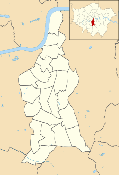
Położenie na mapie gminy Lambeth Contains Ordnance Survey data © Crown copyright and database right, CC BY-SA 3.0 | |
Położenie na mapie Wielkiej Brytanii (c) Karte: NordNordWest, Lizenz: Creative Commons by-sa-3.0 de | |
Położenie na mapie Wielkiego Londynu Contains Ordnance Survey data © Crown copyright and database right, CC BY-SA 3.0 | |
| Portal | |
London Waterloo – stacja kolejowa, jedna z największych w Londynie. Podzielona jest na część krajową i międzynarodową. Do 13 listopada 2007 z części międzynarodowej korzystały pociągi Eurostar zapewniające bezpośrednie połączenie z Paryżem i Brukselą. Obecnie ten fragment jest nieużywany. Stacja posiada 19 peronów i obsłużyła w roku 2005 prawie 68,5 mln pasażerów.
Operatorem wszystkich pociągów zatrzymujących się na dworcu jest obecnie firma South West Trains, której składy jeżdżą stąd m.in. do Woking, Reading, Dorking, Guildford, Weybridge, Basingstoke, Portsmouth, Alton, Southampton, Bournemouth, Poole i Exeter.
Linki zewnętrzne
Media użyte na tej stronie
(c) Karte: NordNordWest, Lizenz: Creative Commons by-sa-3.0 de
Location map of the United Kingdom
Contains Ordnance Survey data © Crown copyright and database right, CC BY-SA 3.0
Map of Greater London, UK with the following information shown:
- Administrative borders
- Coastline, lakes and rivers
- Roads and railways
- Urban areas
The data includes both primary routes and railway lines.
Equirectangular map projection on WGS 84 datum, with N/S stretched 160%
Geographic limits:
- West: 0.57W
- East: 0.37E
- North: 51.72N
- South: 51.25N
Flag of England. Saint George's cross (a red cross on a white background), used as the Flag of England, the Italian city of Genoa and various other places.
Autor: MGalloway (WMF), Licencja: CC BY-SA 3.0
A tickmark icon included in the OOjs UI MediaWiki lib.
Autor: MGalloway (WMF), Licencja: CC BY-SA 3.0
A tickmark icon included in the OOjs UI MediaWiki lib.
Contains Ordnance Survey data © Crown copyright and database right, CC BY-SA 3.0
Blank map of the London Borough of Lambeth, showing electoral wards.
Equirectangular map projection on WGS 84 datum, with N/S stretched 160%
Geographic limits:
- West: 0.17W
- East: 0.05W
- North: 51.515N
- South: 51.405N


