Wauwatosa
| ||||
| ||||
 Widok od strony rzeki | ||||
| Państwo | ||||
| Stan | ||||
| Hrabstwo | Milwaukee | |||
| Data założenia | 1835 | |||
| Kod statystyczny | FIPS: 55-84675 GNIS ID: 1576335 | |||
| Burmistrz | Kathleen Ehley[1] | |||
| Powierzchnia | 23,7 km² | |||
| Wysokość | 210[2] m n.p.m. | |||
| Populacja (2006) • liczba ludności • gęstość | 44 798 1 128 os./km² | |||
| Nr kierunkowy | 414 | |||
| Strefa czasowa | UTC-06:00 UTC-05:00 | |||
| Strona internetowa | ||||
| Portal | ||||
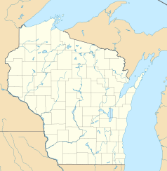
Wauwatosa – miasto w hrabstwie Milwaukee, stanie Wisconsin, USA, nad rzeką Menomonee River. Wchodzące w skład obszaru metropolitalnego miasta Milwaukee. Według spisu z 2006 r. 44 798 mieszkańców.
Historia
Osada została założona w 1935 roku przez 18 rodzin osadników w miejscu nazwanym Wau-wau-too-sa. Nazwa pochodzi od słowa z języka indiańskiego plemienia Potawatomi, oznaczającego świetlika. Według spisu z 1840 miało już 342 mieszkańców. W 1892 miejscowość stała się miasteczkiem (town), a w roku 1897 status został zmieniony na miasto (city). W latach 50. XX wieku granice miasta zostały rozszerzone. Największy rozkwit miasta miał miejsce w latach 60. i na początku 70. Wtedy to liczba populacji wynosiła ponad 58 tys.
Znane osoby związane z miastem
- Matthew Busche - kolarz
- Devin Harris - koszykarz
- Julius Peter Heil - Gubernator stanu Wisconsin
- Tony Smith - koszykarz
- Brad Rowe - aktor
- Spencer Tracy - aktor
- Scott Walker - Gubernator stanu Wisconsin
Przypisy
| ||||||||||
| ||||||||||
Media użyte na tej stronie
Autor: Uwe Dedering, Licencja: CC BY-SA 3.0
Location map of the USA (without Hawaii and Alaska).
EquiDistantConicProjection:
Central parallel:
* N: 37.0° N
Central meridian:
* E: 96.0° W
Standard parallels:
* 1: 32.0° N
* 2: 42.0° N
Made with Natural Earth. Free vector and raster map data @ naturalearthdata.com.
Formulas for x and y:
x = 50.0 + 124.03149777329222 * ((1.9694462586094064-({{{2}}}* pi / 180))
      * sin(0.6010514667026994 * ({{{3}}} + 96) * pi / 180))
y = 50.0 + 1.6155950752393982 * 124.03149777329222 * 0.02613325650382181
      - 1.6155950752393982  * 124.03149777329222 *
     (1.3236744353715044  - (1.9694462586094064-({{{2}}}* pi / 180))
      * cos(0.6010514667026994 * ({{{3}}} + 96) * pi / 180))
The flag of Navassa Island is simply the United States flag. It does not have a "local" flag or "unofficial" flag; it is an uninhabited island. The version with a profile view was based on Flags of the World and as a fictional design has no status warranting a place on any Wiki. It was made up by a random person with no connection to the island, it has never flown on the island, and it has never received any sort of recognition or validation by any authority. The person quoted on that page has no authority to bestow a flag, "unofficial" or otherwise, on the island.
Autor: Oryginalnym przesyłającym był Schwnj z angielskiej Wikipedii, Licencja: CC BY 2.5
Village of Wauwatosa and the Menomonee River.
This is a locator map showing Milwaukee County in Wisconsin. For more information, see Commons:United States county locator maps.
Autor: Alexrk2, Licencja: CC BY 3.0
Ta mapa została stworzona za pomocą GeoTools.


