Wavertree
| Dzielnica Liverpoolu | |
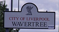
 Tabliczka z nazwą dzielnicy | |
| Państwo | |
|---|---|
| Kraj | |
| Region | |
| Hrabstwo | |
| Dystrykt | Liverpool |
| Miasto | |
| Populacja (2011) • liczba ludności |
|
| Kod pocztowy | L15 |
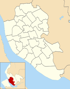
Położenie na mapie Liverpoolu Contains Ordnance Survey data © Crown copyright and database right, CC BY-SA 3.0 | |
Położenie na mapie Wielkiej Brytanii (c) Karte: NordNordWest, Lizenz: Creative Commons by-sa-3.0 de | |
Położenie na mapie Merseyside Contains Ordnance Survey data © Crown copyright and database right, CC BY-SA 3.0 | |
| 53°23′53″N 2°56′01″W/53,398000 -2,933700 | |
| Portal | |
Wavertree jest dzielnicą Liverpoolu, w Merseyside, Anglii[1]. W 2011 miejscowość liczyła 14 772 mieszkańców[2].
Nazwa
Nazwa pochodzi od anglosaskich słów wæfre i treow, oznaczających "Falujące drzewo", prawdopodobnie od występujących powszechnie w okolicy topól.
w przeszłości nazwa zapisywana była w przeróżny sposób Watry, Wartre, Waurtree, Wavertre i Wavertree, lokalnie również jako Wa'tree, aż do końca XIX stulecia.
Historia
Wavertree jest wspomniana w Domesday Book (1086) jako Wauretreu[3].
W połowie lat 1880 odkryto w Parku Wiktorii datowane na epokę brązu urny pochówkowe.
Wavertree było częścią parafii Childwall w West Derby.
Przypisy
- ↑ Ordnance Survey linked data
- ↑ Neighbourhood Statistics. [dostęp 2015-11-15]. [zarchiwizowane z tego adresu (2015-11-17)].
- ↑ The Domesday Book online
Media użyte na tej stronie
(c) Karte: NordNordWest, Lizenz: Creative Commons by-sa-3.0 de
Location map of the United Kingdom
Flag of England. Saint George's cross (a red cross on a white background), used as the Flag of England, the Italian city of Genoa and various other places.
Contains Ordnance Survey data © Crown copyright and database right, CC BY-SA 3.0
Map of Liverpool, Merseyside, UK with electoral wards shown.
Equirectangular map projection on WGS 84 datum, with N/S stretched 165%
Geographic limits:
- West: 3.02W
- East: 2.80W
- North: 53.48N
- South: 53.31N
Autor: Irate (John Bradley)., Licencja: CC BY-SA 3.0
Sign for the Wavertree District of Liverpool.
Contains Ordnance Survey data © Crown copyright and database right, CC BY-SA 3.0
Map of Merseyside, UK with the following information shown:
- Administrative borders
- Coastline, lakes and rivers
- Roads and railways
- Urban areas
Equirectangular map projection on WGS 84 datum, with N/S stretched 165%
Geographic limits:
- West: 3.24W
- East: 2.54W
- North: 53.72N
- South: 53.27N
Autor: Ta PNG grafika rastrowa została stworzona za pomocą Inkscape ., Licencja: CC BY-SA 3.0
The Coat of arms of Liverpool City Council, the local government authority for the City of Liverpool in Merseyside, England. The blazon is:
ARMS: Argent a Cormorant in the beak a Branch of Seaweed called Laver all proper.
CREST: On a Wreath of the Colours a Cormorant the wings elevated in the beak a Branch of Laver proper.


