Welford Road Cemetery (Leicester)
 Stare groby na cmentarzu | |
| Państwo | |
|---|---|
| Kraj | |
| Miejscowość | |
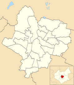
Położenie na mapie Leicesteru Contains Ordnance Survey data © Crown copyright and database right, CC BY-SA 3.0 | |
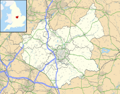
Położenie na mapie Wielkiej Brytanii (c) Karte: NordNordWest, Lizenz: Creative Commons by-sa-3.0 de | |
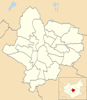
Położenie na mapie Leicestershire Contains Ordnance Survey data © Crown copyright and database right, CC BY-SA 3.0 | |
| 52,6211°N 1,1277°W/52,621100 -1,127700 | |
Welford Road Cemetery – cmentarz wielowyznaniowy położony w mieście Leicester w Wielkiej Brytanii. Cmentarz powstał w 1845 roku, otwarty dla pochówku zmarłych w 1849 r. Cmentarz i budynki cmentarza zaprojektował JR Hamilton, JM Medland, projektanci również cmentarzy w Birmingham i Plymonth[1][2].
Na cmentarzu pochowani są m.in.:
- Thomas Cook - podróżnik, założyciel pierwszego biura podróży
- Arthur Wakerley - brytyjski architekt, przedsiębiorca, polityk
- John Flower - angielski artysta, architekt
- William Green - żołnierz biorący udział w wojnie napoleońskiej
- Bert Harris - sportowiec, brytyjski kolarz
- Witold Letowt - polski lekarz i żołnierz, oficer lotnictwa
Zobacz też
- Gilroes Cemetery
- Belgrave Cemetery
- Saffron Hill Cemetery
Przypisy
- ↑ Zarchiwizowana kopia. [dostęp 2015-02-11]. [zarchiwizowane z tego adresu (2015-02-11)].
- ↑ Zarchiwizowana kopia. [dostęp 2015-02-11]. [zarchiwizowane z tego adresu (2015-02-11)].
Media użyte na tej stronie
(c) Karte: NordNordWest, Lizenz: Creative Commons by-sa-3.0 de
Location map of the United Kingdom
Flag of England. Saint George's cross (a red cross on a white background), used as the Flag of England, the Italian city of Genoa and various other places.
Symbol miejsca kultu do legendy mapy
Autor: NotFromUtrecht, Licencja: CC BY-SA 3.0
Welford Road Cemetery in Leicester. The photograph demonstrates the symmetrical layout of the cemetery: the area on the left is unconsecrated ground for non-conformists, while the area on the right is consecrated ground for Anglicans. There is a noticeable difference between the monuments in each area.
Contains Ordnance Survey data © Crown copyright and database right, CC BY-SA 3.0
Map of Leicester, Leicestershire, UK with electoral wards shown.
Equirectangular map projection on WGS 84 datum, with N/S stretched 160%
Geographic limits:
- West: 1.22W
- East: 1.04W
- North: 52.70N
- South: 52.57N
Contains Ordnance Survey data © Crown copyright and database right, CC BY-SA 3.0
Map of Leicestershire, UK with the following information shown:
- Administrative borders
- Coastline, lakes and rivers
- Roads and railways
- Urban areas
Equirectangular map projection on WGS 84 datum, with N/S stretched 160%
Geographic limits:
- West: 1.80W
- East: 0.50W
- North: 53.00N
- South: 52.36N
Autor: NotFromUtrecht, Licencja: CC BY-SA 3.0
Welford Road Cemetery in Leicester.


