West Somerset
| dystrykt niemetropolitalny | |
| Państwo | |
|---|---|
| Kraj | |
| Region | South West England |
| Hrabstwo | Somerset |
| Siedziba | Williton |
| Powierzchnia | 726,84 km² |
| Populacja (2011) • liczba ludności | 34 675 |
| • gęstość | 48 os./km² |
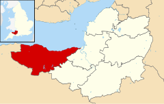
| Położenie na mapie Somerset Contains Ordnance Survey data © Crown copyright and database right, CC BY-SA 3.0 | |
| Strona internetowa | |
| Portal | |
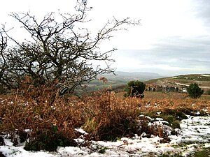
West Somerset – dawny dystrykt niemetropolitalny w Anglii w hrabstwie Somerset, położony w zachodniej części hrabstwa między wzgórzami Quantock Hills i Kanałem Bristolskim. Centrum administracyjnym było Williton. W 2011 roku dystrykt liczył 34 675 mieszkańców[1].
Dystrykt utworzony został 1 kwietnia 1974. Funkcjonował do 1 kwietnia 2019 roku, kiedy to w wyniku połączenia z sąsiednim Taunton Deane, utworzony został dystrykt Somerset West and Taunton[2].
Miasta
Inne miejscowości
Allerford, Bicknoller, Blue Anchor, Brompton Ralph, Brompton Regis, Brushford, Carhampton, Clatworthy, Crowcombe, Culbone, Cutcombe, Dunster, East Quantoxhead, Elworthy, Exford, Exton, Holford, Huish Champflower, Kilve, Lilstock, Luccombe, Luxborough, Monksilver, Oare, Old Cleeve, Porlock, Roadwater, Sampford Brett, Selworthy, Simonsbath, Skilgate, Stogumber, Stogursey, Stringston, Timberscombe, Treborough, Upton, Washford, West Quantoxhead, Williton, Winsford, Withycombe, Withypool, Wootton Courtenay.
Przypisy
- ↑ Taunton Deane Local Authority (ang.). Nomis. [dostęp 2019-05-04].
- ↑ New council (ang.). Somerset West and Taunton, 2019-03-28. [dostęp 2015-05-04]. [zarchiwizowane z tego adresu (2019-05-04)].
Media użyte na tej stronie
Flag of England. Saint George's cross (a red cross on a white background), used as the Flag of England, the Italian city of Genoa and various other places.
Contains Ordnance Survey data © Crown copyright and database right, CC BY-SA 3.0
Map of Somerset, UK with West Somerset highlighted.
Equirectangular map projection on WGS 84 datum, with N/S stretched 155%


