Westerveld
| |||||
Miasto Dwingeloo | |||||
| |||||
| Państwo | |||||
| Prowincja | |||||
| Burmistrz | Rikus Jager (2014)[1] | ||||
| Powierzchnia | 282,74 km² | ||||
| Populacja (2014) • liczba ludności • gęstość | 18 902 [2] 68 os./km² | ||||
| Nr kierunkowy | 0521, 0561 | ||||
| Kod pocztowy | 7970-7999, 8350-8354, 8380-8387, 8437-8439 | ||||
| Strona internetowa | |||||
Westerveld - gmina w prowincji Drenthe w Holandii. W 2014 roku populacja wyniosła 18 902 mieszkańców. Powstała w 1998 roku z połączenia gmin Havelte, Diever, Dwingeloo i Vledder.
Przez gminę przechodzą autostrada A32 oraz drogi prowincjonalne N371, N352 oraz N855.
Miejscowości
Stolicą gminy jest miejscowość Diever.
| Nazwa | Populacja | Nazwa | Populacja | Nazwa | Populacja w 2010 roku [3] |
|---|---|---|---|---|---|
| Havelte | 3.645 | Darp | 610 | Frederiksoord | 215 |
| Diever | 2.710 | Nijensleek | 525 | Havelterberg | 205 |
| Dwingeloo | 2.675 | Geeuwenbrug | 445 | Boschoord | 195 |
| Vledder | 1.965 | Zorgvlied | 410 | Wittelte | 140 |
| Uffelte | 1.440 | Lhee | 370 | Lheebroek | 130 |
| Wilhelminaoord | 915 | Vledderveen | 355 | Leggeloo | 130 |
| Wapserveen | 790 | Eemster | 325 | Doldersum | 115 |
| Wapse | 625 | Dieverbrug | 300 | Westeinde | 115 |
Przypisy
- ↑ gemeentewesterveld.nl: Burgemeester Rikus Jager (niderl.). [dostęp 2014-07-10].
- ↑ Aktualna liczba mieszkańców miasta (nl) [dostęp 21 kwietnia 2014]
- ↑ CBS Statline
Media użyte na tej stronie
Autor: Erik Frohne, Licencja: CC BY-SA 3.0
Location map of province Drenthe in the Netherlands
Equirectangular projection, N/S stretching 166 %. Geographic limits of the map:
- N: 53.30° N
- S: 52.60° N
- W: 6.10° E
- E: 7.10° E
(c) Rijksdienst voor het Cultureel Erfgoed, CC BY-SA 4.0
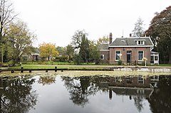
To jest zdjęcie holenderskiego zabytku (rijksmonument) numer 507317
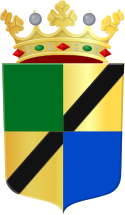
Coat of arms of the Dutch municipality of Westerveld.
Logo of Westerveld


