Westvoorne
| |||||
| |||||
| Państwo | |||||
| Prowincja | Holandia Południowa | ||||
| Burmistrz | Peter de Jong (2014)[1] | ||||
| Powierzchnia | 97,48 km² | ||||
| Populacja (2014) • liczba ludności | 13 977 [2] | ||||
| Kod pocztowy | 3233–3235 | ||||
| Strona internetowa | |||||
Westvoorne – gmina w prowincji Holandia Południowa w Holandii.
Przypisy
- ↑ westvoorne.nl: Burgemeester Peter de Jong (niderl.). [dostęp 2020-08-26].
- ↑ Aktualna liczba mieszkańców gminy (nl) [dostęp 12 lipca 2014]
Kontrola autorytatywna (municipality of the Netherlands):
Media użyte na tej stronie
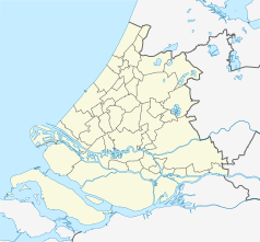
Netherlands South Holland location map.svg
Autor: Erik Frohne, Licencja: CC BY-SA 3.0
Location map of province South Holland in the Netherlands
Autor: Erik Frohne, Licencja: CC BY-SA 3.0
Location map of province South Holland in the Netherlands
Equirectangular projection, N/S stretching 162 %. Geographic limits of the map:
- N: 52.40° N
- S: 51.60° N
- W: 3.80° E
- E: 5.20° E
Flag of Westvoorne.svg
Flag of the Dutch municipality of Westvoorne.
Flag of the Dutch municipality of Westvoorne.
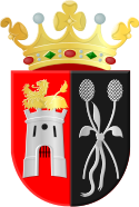
Westvoorne wapen.svg
Coats of arms of Westvoorne
Coats of arms of Westvoorne
Overzicht voorgevel - Oostvoorne - 20377251 - RCE.jpg
(c) Rijksdienst voor het Cultureel Erfgoed, CC BY-SA 4.0
Raadhuis: Overzicht voorgevel (opmerking: Gefotografeerd voor Monumenten In Nederland Zuid-Holland)
(c) Rijksdienst voor het Cultureel Erfgoed, CC BY-SA 4.0
Raadhuis: Overzicht voorgevel (opmerking: Gefotografeerd voor Monumenten In Nederland Zuid-Holland)


