Whitland
| ||
(c) Roger Cornfoot, CC BY-SA 2.0 Ulica w centrum Whitland | ||
| Państwo | ||
| Księstwo | ||
| Hrabstwo | Carmarthenshire | |
| Populacja (2011) • liczba ludności | 1514[1] | |
Położenie na mapie Carmarthenshire Contains Ordnance Survey data © Crown copyright and database right, CC BY-SA 3.0 | ||
Położenie na mapie Wielkiej Brytanii (c) Karte: NordNordWest, Lizenz: Creative Commons by-sa-3.0 de | ||
| Portal | ||
Whitland (wal. Hendy-gwyn) – miasto w południowo-zachodniej Walii, w hrabstwie Carmarthenshire, położone nad rzeką Taf[2]. W 2011 roku liczyło 1514 mieszkańców[1].
W pobliżu znajdują się pozostałości cysterskiego opactwa Whitland Abbey, założonego w połowie XII wieku[3].
Działa tu stacja kolejowa[4].
Przypisy
- ↑ a b Whitland Built-up area Local Area Report (ang.). Nomis. [dostęp 2020-01-11].
- ↑ Whitland, Carmarthenshire (ang.). A vision of Britain through time. [dostęp 2020-01-11].
- ↑ Whitland Abbey (ang.). Coflein. [dostęp 2020-01-11].
- ↑ Whitland Station (ang.). Transport for Wales. [dostęp 2020-01-11].
Media użyte na tej stronie
(c) Karte: NordNordWest, Lizenz: Creative Commons by-sa-3.0 de
Location map of the United Kingdom
Autor: NordNordWest, Licencja: CC BY-SA 3.0
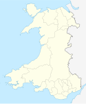
Location map of Wales, United Kingdom
Contains Ordnance Survey data © Crown copyright and database right, CC BY-SA 3.0
Blank map of Carmarthenshire, UK with the following information shown:
- Administrative borders
- Coastline, lakes and rivers
- Roads and railways
- Urban areas
Equirectangular map projection on WGS 84 datum, with N/S stretched 160%
Geographic limits:
- West: 4.75W
- East: 3.58W
- North: 52.15N
- South: 51.58N
(c) Roger Cornfoot, CC BY-SA 2.0
West Street, Whitland


