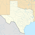
Wichita Falls
 Śródmieście Wichita Falls. | |
| Państwo | |
|---|---|
| Stan | |
| Hrabstwo | |
| Data założenia | 1876[1] |
| Prawa miejskie | 1889[1] |
| Kod statystyczny | |
| Zarządzający | Stephen Santellana↗ |
| Powierzchnia | 186,6 km² |
| Wysokość | 289 m n.p.m. |
| Populacja (2020) • liczba ludności • gęstość |
|
| Nr kierunkowy | 940 |
| Kod pocztowy | 76301 - 76310 |
| Strefa czasowa | |
| Strona internetowa | |
| Portal | |
Wichita Falls – miasto w Stanach Zjednoczonych, w północnym Teksasie, nad rzeką Wichita (dopływ rzeki Red River). Według spisu w 2020 roku liczy 102,3 tys. mieszkańców[2]. W mieście rozwinął się przemysł maszynowy, szklarski, odzieżowy oraz elektroniczny[1].
Baza Sił Powietrznych Sheppard jest najważniejszym i największym ośrodkiem Dowództwa Edukacji i Szkolenia Lotniczego (AETC)[3]. Znajduje się około 10 km na północ od centralnej dzielnicy biznesowej Wichita Falls[4].
Od 1922 r. w mieście działa uniwersytet[1].
Demografia
Przypisy
- ↑ a b c d Wichita Falls, [w:] Encyklopedia PWN [online] [dostęp 2021-08-28].
- ↑ U.S. Census Bureau QuickFacts: Wichita Falls city, Texas; Wichita County, Texas; Texas, www.census.gov [dostęp 2022-02-07] (ang.).
- ↑ Sheppard Air Force Base in Wichita Falls, TX | MilitaryBases.com, Military Bases [dostęp 2022-02-07] (ang.).
- ↑ Sheppard Air Force Base | AIS, www.ais-inc.com [dostęp 2022-02-07].
Media użyte na tej stronie
Autor: Alexrk, Licencja: CC BY 3.0
Ta mapa została stworzona za pomocą GeoTools.
Autor: Uwe Dedering, Licencja: CC BY-SA 3.0
Location map of the USA (without Hawaii and Alaska).
EquiDistantConicProjection:
Central parallel:
* N: 37.0° N
Central meridian:
* E: 96.0° W
Standard parallels:
* 1: 32.0° N
* 2: 42.0° N
Made with Natural Earth. Free vector and raster map data @ naturalearthdata.com.
Formulas for x and y:
x = 50.0 + 124.03149777329222 * ((1.9694462586094064-({{{2}}}* pi / 180))
      * sin(0.6010514667026994 * ({{{3}}} + 96) * pi / 180))
y = 50.0 + 1.6155950752393982 * 124.03149777329222 * 0.02613325650382181
      - 1.6155950752393982  * 124.03149777329222 *
     (1.3236744353715044  - (1.9694462586094064-({{{2}}}* pi / 180))
      * cos(0.6010514667026994 * ({{{3}}} + 96) * pi / 180))
The flag of Navassa Island is simply the United States flag. It does not have a "local" flag or "unofficial" flag; it is an uninhabited island. The version with a profile view was based on Flags of the World and as a fictional design has no status warranting a place on any Wiki. It was made up by a random person with no connection to the island, it has never flown on the island, and it has never received any sort of recognition or validation by any authority. The person quoted on that page has no authority to bestow a flag, "unofficial" or otherwise, on the island.
Autor: Autor nie został podany w rozpoznawalny automatycznie sposób. Założono, że to Billy Hathorn (w oparciu o szablon praw autorskich)., Licencja: CC BY-SA 3.0
I took photo of downtown block in Wichita Falls with Holt Hotel on the right, American Bank building in the back right, and the original Zales jewelry outlet on the front left. With Canon camera, April 6, 2013. Billy Hathorn (talk) 17:06, 10 April 2013 (UTC)


