Wieża zegarowa w Leicesterze
 Wygląd wieży w 2010 roku | |
| Państwo | |
|---|---|
| Kraj | |
| Miejscowość | |
| Ukończenie budowy | 1868 |
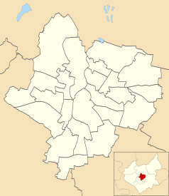
Położenie na mapie Leicesteru Contains Ordnance Survey data © Crown copyright and database right, CC BY-SA 3.0 | |
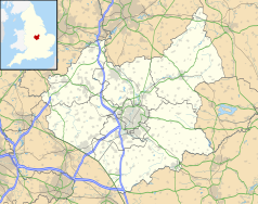
Położenie na mapie Wielkiej Brytanii (c) Karte: NordNordWest, Lizenz: Creative Commons by-sa-3.0 de | |
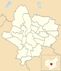
Położenie na mapie Leicestershire Contains Ordnance Survey data © Crown copyright and database right, CC BY-SA 3.0 | |
| 52,636213°N 1,133086°W/52,636213 -1,133086 | |
Wieża zegarowa w Leicesterze – wieża zegarowa wybudowana w 1868 roku w centrum miasta Leicester w Wielkiej Brytanii. Wieża jest z granitu, natomiast umieszczone na niej posągi z wapienia portlandzkiego[1].
Wieża zegarowa znajduje się w centrum miasta między pięcioma ulicami: Church Gate, Haymarket Street, Humberstone Gate, Gallowtree Gate oraz East Gates. Stanowi punkt orientacyjny oraz miejsce spotkań zarówno mieszkańców, jak i przyjezdnych.
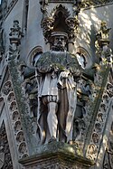
Na wieży są cztery rzeźby postaci związanych z historią miasta Leicester: Simona de Montforta, Williama Wyggestona, Thomasa White i Gabriela Newtona[2].
Wysokość wieży wynosi około 12 metrów.
Przypisy
- ↑ BBC - Leicester Clock Tower gets repaired after 70 years, BBC (ang.)
- ↑ The Clock Tower. leicester.gov.uk. [zarchiwizowane z tego adresu (2011-03-26)]., Leicester City Council (ang.)
Media użyte na tej stronie
(c) Karte: NordNordWest, Lizenz: Creative Commons by-sa-3.0 de
Location map of the United Kingdom
Contains Ordnance Survey data © Crown copyright and database right, CC BY-SA 3.0
Map of Leicestershire, UK with the following information shown:
- Administrative borders
- Coastline, lakes and rivers
- Roads and railways
- Urban areas
Equirectangular map projection on WGS 84 datum, with N/S stretched 160%
Geographic limits:
- West: 1.80W
- East: 0.50W
- North: 53.00N
- South: 52.36N
Flag of England. Saint George's cross (a red cross on a white background), used as the Flag of England, the Italian city of Genoa and various other places.
Autor: NotFromUtrecht, Licencja: CC BY-SA 3.0
A statue of Sir Thomas White on the Haymarket Memorial Clock Tower in Leicester, England.
Contains Ordnance Survey data © Crown copyright and database right, CC BY-SA 3.0
Map of Leicester, Leicestershire, UK with electoral wards shown.
Equirectangular map projection on WGS 84 datum, with N/S stretched 160%
Geographic limits:
- West: 1.22W
- East: 1.04W
- North: 52.70N
- South: 52.57N
Autor: NotFromUtrecht, Licencja: CC BY-SA 3.0
A statue of Simon de Montfort on the Haymarket Memorial Clock Tower in Leicester, England.
Autor: NotFromUtrecht, Licencja: CC BY-SA 3.0
A statue of Gabriel Newton on the Haymarket Memorial Clock Tower in Leicester, England.
Autor: NotFromUtrecht, Licencja: CC BY-SA 3.0
A statue of William Wigston on the Haymarket Memorial Clock Tower in Leicester, England.


