Wierchniaja Sałda
 | |||||
| Państwo | |||||
|---|---|---|---|---|---|
| Obwód | |||||
| Populacja (2007) • liczba ludności |
| ||||
| Nr kierunkowy | +7 34345 | ||||
| Kod pocztowy | 624760 | ||||
| Tablice rejestracyjne | 66 | ||||
| Strona internetowa | |||||
| Portal | |||||
Wierchniaja Sałda (ros. Верхняя Салда) – miasto w Federacji Rosyjskiej. Centrum administracyjne rejonu wierchniesałdińskiego w obwodzie swierdłowskim. W 2005 roku miasto liczyło 50,1 tys. mieszkańców.
Położone nad rzeką Sałda, 195 km od Jekaterynburga.
Historia
Miasto powstało w 1778 roku jako osiedle budowniczych zakładów metalurgicznych. Osada rozrastała się, przybywało mieszkańców. Prawa miejskie nadano 24 grudnia 1938 roku.
Media użyte na tej stronie
Verkhnyaya Salda (Sverdlovsk oblast), flag
Autor: Uwe Dedering, Licencja: CC BY-SA 3.0
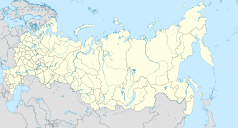
Location map of Russia.
EquiDistantConicProjection : Central parallel :
* N: 54.0° N
Central meridian :
* E: 100.0° E
Standard parallels:
* 1: 49.0° N
* 2: 59.0° N
Made with Natural Earth. Free vector and raster map data @ naturalearthdata.com.
Because the southern Kuril islands are claimed by Russia and Japan, they are shown as disputed. For more information about this see: en:Kuril Islands dispute. These islands are since 1945 under the jurisdiction of the Russian Federation.
Autor: Ludvig14, Licencja: CC BY-SA 4.0
To fotografia pomnika kulturowego dziedzictwa w Rosji; numer:
Map of Sverdlovskaya oblast (Russia), in the Mercator projection.
Verkhnyaya Salda (Sverdlovsk oblast), coat of arms


