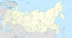
Wierchniewilujsk
| Państwo | |
|---|---|
| Republika | |
| Populacja • liczba ludności |
|
| Nr kierunkowy | 8)41133 |
| Kod pocztowy | 678230 |
Wierchniewilujsk (ros. Верхневилюйск, jakuc. Үөһээ Бүлүү) – wieś (ros. село, trb. sieło) w autonomicznej rosyjskiej republice Jakucji, ośrodek administracyjny ułusu (rejonu) wierchniewilujskiego.
Zobacz też
Media użyte na tej stronie
Autor: Uwe Dedering, Licencja: CC BY-SA 3.0
Location map of Russia.
EquiDistantConicProjection : Central parallel :
* N: 54.0° N
Central meridian :
* E: 100.0° E
Standard parallels:
* 1: 49.0° N
* 2: 59.0° N
Made with Natural Earth. Free vector and raster map data @ naturalearthdata.com.
Because the southern Kuril islands are claimed by Russia and Japan, they are shown as disputed. For more information about this see: en:Kuril Islands dispute. These islands are since 1945 under the jurisdiction of the Russian Federation.
Flag of Sakha
Autor:
- Позиционная_карта_Якутии.jpg: проекцию изменил.
Oryginalnym przesyłającym był Виктор В z rosyjskiej Wikipedii
- Russia_edcp_location_map.svg: Uwe Dedering
- derivative work: Odysseus1479 (talk)
Location map of Yakutia, Russian Federation.


