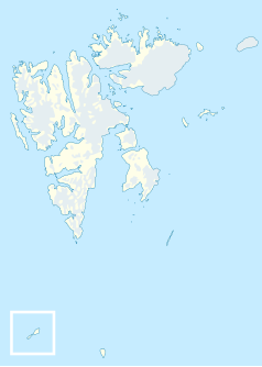
Wijdefjorden
 Fiord oznaczono małą literą l | |
| Państwo | |
|---|---|
| Terytorium zależne | |
Wijdefjorden - to pierwszy pod względem długości fiord znajdujący się w północnej części wyspy Spitsbergen, w archipelagu Svalbard leżącego na Morzu Arktycznym, terenu zależnego od Norwegii. Fiord ma długość około 108 km[1] i wchodzi w skład norweskiego Parku Narodowego Wijdefjorden.
Przypisy
Media użyte na tej stronie
Autor: The source file is from Uwe Dedering, Licencja: CC BY-SA 3.0
Relief location map of the Arctic Ocean.
- Projection: Azimuthal equidistant projection.
- Area of interest:
- N: 90.0° N
- S: 70.0° N
- W: -180.0° E
- E: 180.0° E
- Projection center:
- NS: 90° N
- WE: 0° E
Autor: NordNordWest, Licencja: CC BY-SA 3.0
Location map of Svalbard, Norway
Map detailing the marine features of Spitsbergen in the Svalbard archipelago. Settlements and mountains are indicated and labelled. See also Image:Spitsbergen mountains and marine features labelled.png. Locations were labelled based on detailed maps from svalbard-images.com (sample of south Spitsbergen linked), cross-referenced with other map sources. Norwegian Polar Institute figures were used for mountain names and heights, which are given in meters above sea level.


