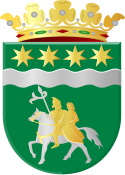
Winsum
 | |||||
| Państwo | |||||
|---|---|---|---|---|---|
| Prowincja | |||||
| Burmistrz | Rinus Michels (2014)[1] | ||||
| Powierzchnia | 102.53 [2] km² | ||||
| Populacja (2014) • liczba ludności • gęstość | 13,843 [3] 137 os./km² | ||||
| Nr kierunkowy | 0595 | ||||
| Kod pocztowy | 9770–9779 | ||||
| Strona internetowa | |||||
Winsum – miasto i gmina w prowincji Groningen w Holandii. Liczy 13,843 tys. mieszkańców (2014).
Winsun powstało oficjalnie w 1057 roku jako połączone trzech wiosek: Winsun, Obergum oraz Bellingeweer. Większość mieszkańców miasta pracuje w pobliskim dużym mieście, Groningen.
W mieście znajdują się dwa tradycyjne, holenderskie wiatraki - De Ster (zbudowany 1851, pol. Gwiazda) oraz De Vriendschap (zbudowany 1801, pol. Przyjaźń). Prócz tego w mieście są dwa zabytkowe kościoły, dwa kanały i jedna z najstarszych tawern w Holandii De Gouden Karper (Złoty Karp).
Winsum organizuje zawody w kolarstwie szosowym. [4]
Miasta partnerskie
Przypisy
- ↑ winsum.nl: College van burgemeester en wethouders gemeente Winsum (niderl.). [dostęp 2014-07-10].
- ↑ Informacje o powierzchni
- ↑ Aktualna liczba mieszkańców miasta (nl) [dostęp 14 kwietnia 2014]
- ↑ nusport.nl
Linki zewnętrzne
Media użyte na tej stronie
Flag of the Province of Groningen, Netherlands. See for a photo of the flag. For colour conversions for Pantone were used coated instead of uncoated colours. The chart used was Commons:Pantone color chart.
Flag of the Dutch municipality of Winsum
Autor: Erik Frohne, Licencja: CC BY-SA 3.0
Location map of province Groningen in the Netherlands
Equirectangular projection, N/S stretching 167 %. Geographic limits of the map:
- N: 53.60° N
- S: 52.80° N
- W: 6.10° E
- E: 7.30° E
Autor: Michielverbeek, Licencja: CC BY-SA 3.0 nl
To jest zdjęcie holenderskiego zabytku (rijksmonument) numer 39029
Autor: Michielverbeek, Licencja: CC BY-SA 3.0 nl
To jest zdjęcie holenderskiego zabytku (rijksmonument) numer 39030


