Wisconsin Rapids
| ||
 Siedziba władz hrabstwa Wood w Wisconsin Rapids | ||
| Państwo | ||
| Stan | ||
| Hrabstwo | Wood | |
| Powierzchnia | 35,79[1] km² | |
| Populacja (2016) • liczba ludności • gęstość | 17 887[1] 499,8 os./km² | |
| Strona internetowa | ||
| Portal | ||
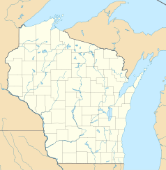
Wisconsin Rapids – miasto (city), ośrodek administracyjny hrabstwa Wood[2], w środkowej części stanu Wisconsin, w Stanach Zjednoczonych, położone nad rzeką Wisconsin[3]. W 2016 roku miasto liczyło 17 887 mieszkańców[1].
Pierwszymi europejskimi osadnikami, którzy przybyli w te rejony w latach 20. XIX wieku, byli handlarze futrem. Na przeciwnych brzegach rzeki założone zostały dwie osady – Centralia na zachodnim, Grand Rapids na wschodnim. W 1900 obie miejscowości połączyły się tworząc miasto Grand Rapids[3]. Nazwa miasta była przyczyną częstych problemów z niedocieraniem przesyłek pocztowych, które trafiły do znacznie większego Grand Rapids w stanie Michigan, toteż w 1920 roku zmieniono ją na obecną, Wisconsin Rapids[4].
Miasto rozwinęło się jako ośrodek przemysłu papierniczego i spożywczego. Ważną rolę w lokalnej gospodarce odgrywa rolnictwo, w szczególności uprawa żurawiny[3].
Przypisy
- ↑ a b c Wisconsin Rapids (city), Wisconsin (ang.). QuickFacts from the US Census Bureau. [dostęp 2017-11-27].
- ↑ Wood County, Wisconsin (ang.). [dostęp 2017-11-27].
- ↑ a b c Area History (ang.). Wisconsin Rapids. [dostęp 2017-11-27].
- ↑ A short history of Wisconsin Rapids (ang.). McMillan Memorial Library. [dostęp 2017-11-27].
| ||||||||||
Media użyte na tej stronie
Autor: Alexrk2, Licencja: CC BY 3.0
Ta mapa została stworzona za pomocą GeoTools.
Autor: Uwe Dedering, Licencja: CC BY-SA 3.0
Location map of the USA (without Hawaii and Alaska).
EquiDistantConicProjection:
Central parallel:
* N: 37.0° N
Central meridian:
* E: 96.0° W
Standard parallels:
* 1: 32.0° N
* 2: 42.0° N
Made with Natural Earth. Free vector and raster map data @ naturalearthdata.com.
Formulas for x and y:
x = 50.0 + 124.03149777329222 * ((1.9694462586094064-({{{2}}}* pi / 180))
      * sin(0.6010514667026994 * ({{{3}}} + 96) * pi / 180))
y = 50.0 + 1.6155950752393982 * 124.03149777329222 * 0.02613325650382181
      - 1.6155950752393982  * 124.03149777329222 *
     (1.3236744353715044  - (1.9694462586094064-({{{2}}}* pi / 180))
      * cos(0.6010514667026994 * ({{{3}}} + 96) * pi / 180))
The flag of Navassa Island is simply the United States flag. It does not have a "local" flag or "unofficial" flag; it is an uninhabited island. The version with a profile view was based on Flags of the World and as a fictional design has no status warranting a place on any Wiki. It was made up by a random person with no connection to the island, it has never flown on the island, and it has never received any sort of recognition or validation by any authority. The person quoted on that page has no authority to bestow a flag, "unofficial" or otherwise, on the island.
Autor: TheCatalyst31, Licencja: CC0
The Wood County Courthouse in Wisconsin Rapids, Woood County, Wisconsin.


