Wolfhalden
 | |||
| |||
| Państwo | |||
|---|---|---|---|
| Kanton | |||
| SFOS | 3038 | ||
| Powierzchnia | 6,94 km² | ||
| Wysokość | 716 m n.p.m. | ||
| Populacja (31 grudnia 2014) • liczba ludności • gęstość |
| ||
| Nr kierunkowy | 071 | ||
| Kod pocztowy | 9427 | ||
| Tablice rejestracyjne | AR | ||
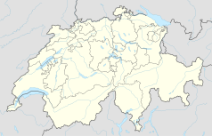
Położenie na mapie Szwajcarii (c) Karte: NordNordWest, Lizenz: Creative Commons by-sa-3.0 de | |||
| Strona internetowa | |||
Wolfhalden (gsw. Wolfhalde) – gmina (niem. Einwohnergemeinde)] w północno-wschodniej Szwajcarii, w kantonie Appenzell Ausserrhoden. 31 grudnia 2014 liczyła 1741 mieszkańców. Do 1995 należała do okręgu Vorderland.
Media użyte na tej stronie
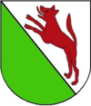
Coat of arms of Wolfhalden, Canton of Appenzell Ausserrhoden, Switzerland
Autor: böhringer friedrich, Licencja: CC BY-SA 2.5
Appenzeller Bauernhaus gelegen an der Oberlindenberg Strasse in Wolfhalden.
Flag of the Canton of Appenzell Ausserrhoden in Switzerland
Autor: Abaddon1337, Licencja: CC BY-SA 3.0
Fork from media:Karte Kanton Appenzell Ausserrhoden Bezirke 2010.png for geolocalisation
(c) Karte: NordNordWest, Lizenz: Creative Commons by-sa-3.0 de
Location map of Switzerland


