Wyspa Edge’a
| ||
 Zdjęcie satelitarne Wysp Edge'a i Barentsa (powyżej) | ||
| Kontynent | Europa | |
| Państwo | ||
| Terytorium zależne | ||
| Akwen | Morze Barentsa | |
| Powierzchnia | 5074 km² | |
| Populacja • liczba ludności | 0 | |
 | ||
Wyspa Edge'a (norw. Edgeøya) – niezamieszkana wyspa wchodząca w skład norweskiego archipelagu Svalbard, położona na południowy wschód od głównej wyspy Spitsbergen. Od położonej na północy Wyspy Barentsa oddziela ją Cieśnina Freemana. Zajmuje powierzchnię 5074 km² (trzecia pod względem wielkości po Spitsbergenie i Ziemi Północno-Wschodniej).

Wyspa stanowi rezerwat przyrody. Spotkać tu można niedźwiedzie polarne i renifery. Ponad 40% powierzchni wyspy (2102 km²) pokryta jest lodowcami.
Wyspa nazwana została na cześć Thomasa Edge'a (zm. 1624), angielskiego handlarza i wielorybnika.
Media użyte na tej stronie
Autor: NordNordWest, Licencja: CC BY-SA 3.0
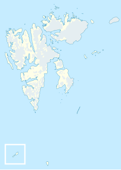
Location map of Svalbard, Norway
Map detailing the marine features of Edgeøya in the Svalbard archipelago. Locations were labelled mainly based on detailed maps from svalbard-images.com, cross-referenced with other map sources where possible. Norwegian Polar Institute data was also used.
Autor: Lars H. Smedsrud, Licencja: CC BY-SA 3.0
Sea ice in Storfjorden, Svalbard. Edgeøya in the background. This is first year's ice, but the strong currents in the Freeman Strait have packed the ice rather heavily.
Autor: The source file is from Uwe Dedering, Licencja: CC BY-SA 3.0
Relief location map of the Arctic Ocean.
- Projection: Azimuthal equidistant projection.
- Area of interest:
- N: 90.0° N
- S: 70.0° N
- W: -180.0° E
- E: 180.0° E
- Projection center:
- NS: 90° N
- WE: 0° E
Terra MODIS satellite image of Edgeøya (bottom) and Barentsøya (top), Svalbard


