Xalapa-Enríquez
 | |||||
| Państwo | |||||
|---|---|---|---|---|---|
| Stan | |||||
| Gmina | Xalapa-Enríquez | ||||
| Burmistrz | Pedro Hipólito Rodríguez Herrero | ||||
| Powierzchnia | 118,45 km² | ||||
| Wysokość | 1480 m n.p.m. | ||||
| Populacja (2010) • liczba ludności |
| ||||
| Nr kierunkowy | 228 | ||||
| Kod pocztowy | 91000 | ||||
| Strona internetowa | |||||
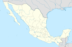
Xalapa-Enríquez (również Jalapa) – miasto we wschodnim Meksyku, w górach Sierra Madre Wschodnia, na wysokości 1430 metrów, stolica stanu Veracruz. Miasto leży w centrum stanu, w odległości 105 km od największego portu w stanie Veracruz oraz około 330 km od stolicy kraju miasta Meksyk. W 2010 roku miasto liczyło ponad 420 tys. mieszkańców[1].
Nazwa Xalapa pochodzi od słów w języku Nahuatl xal-li oznaczające piasek oraz a-pan oznaczające miejsce z wodą co można tłumaczyć jako źródło na piasku.
Urodziła się tutaj Sara Maldonado, meksykańska aktorka.
Miasta partnerskie
 Perote, Meksyk
 Omaha, Stany Zjednoczone
 Cotija, Meksyk
 Antigua Guatemala, Gwatemala
 Puebla, Meksyk
 Torreón, Meksyk
 Laredo, Stany Zjednoczone
 Acayucan, Meksyk
 Veracruz, Meksyk
 Mobile, Stany Zjednoczone
 Cancún, Meksyk
 Parana, Argentyna
 Santiago de Querétaro, Meksyk
 Durango, Meksyk
 Matamoros, Meksyk
 Columbia, Stany Zjednoczone
 Palma de Mallorca, Hiszpania
Warunki pogodowe
| Miesiąc | Sty | Lut | Mar | Kwi | Maj | Cze | Lip | Sie | Wrz | Paź | Lis | Gru | Roczna |
|---|---|---|---|---|---|---|---|---|---|---|---|---|---|
| Rekordy maksymalnej temperatury [°C] | 32.2 | 33.8 | 37.4 | 38.2 | 39.7 | 37.4 | 35.5 | 32.3 | 31.4 | 33.1 | 33.0 | 32.4 | 34,7 |
| Średnie temperatury w dzień [°C] | 22 | 22.8 | 27 | 28.7 | 30.7 | 26.7 | 25.2 | 27 | 25.7 | 25 | 23.7 | 22.6 | 25,3 |
| Średnie temperatury w nocy [°C] | 10.9 | 11.2 | 14.2 | 15.5 | 17.3 | 16.8 | 15.7 | 16.0 | 16.2 | 15.2 | 13.1 | 11.1 | 14,4 |
| Rekordy minimalnej temperatury [°C] | -2.4 | 1.9 | 3.6 | 6.5 | 8.5 | 10.2 | 11.5 | 10.4 | 9.8 | 8.1 | 5.8 | 3.6 | 6,4 |
| Opady [mm] | 49.4 | 41.1 | 47.9 | 84.6 | 118.2 | 253.3 | 202.9 | 184.3 | 225.8 | 120.8 | 58.5 | 45.2 | 1432,0 |
| Źródło: Servicio Meteorológico Nacional[2] 2009.03.01 | |||||||||||||
Zobacz też
Przypisy
- ↑ a b Principales resultados por localidad 2010 (ITER). Instituto Nacional de Estadística, Geografía e Informática.. [dostęp 2015-08-03]. (hiszp.).
- ↑ Servicio Meteorológico Nacional Normales climatológicas de 1981-2000 para Xalapa, Veracruz. Servicio Meteorológico Nacional. [dostęp 2009-03-01]. (hiszp.).
Media użyte na tej stronie
The flag of Navassa Island is simply the United States flag. It does not have a "local" flag or "unofficial" flag; it is an uninhabited island. The version with a profile view was based on Flags of the World and as a fictional design has no status warranting a place on any Wiki. It was made up by a random person with no connection to the island, it has never flown on the island, and it has never received any sort of recognition or validation by any authority. The person quoted on that page has no authority to bestow a flag, "unofficial" or otherwise, on the island.
Autor: Pedro A. Gracia Fajardo, escudo de Manual de Imagen Institucional de la Administración General del Estado, Licencja: CC0
Flaga Hiszpanii
Location Map of en:Veracruz Equirectangular projection, Geographic limits of the map:
- N: 22.57° N
- S: 16.96° N
- W: 98.87° W
- E: 93.45° W
Escudo de armas del municipio Xalapa
Flag of Veracruz
Escudo de la ciudad de Veracruz, México, otorgado por el Emperador Carlos V.
Coat of mexican Veracruz City, given by Charles V, Holy Roman Emperor.Autor: Eneas De Troya from Mexico City, México, Licencja: CC BY 2.0
Vista del Pico de Orizaba desde Xalapa, Veracruz, México.


