Yakima
 Panorama Yakimy | |
| Państwo | |
|---|---|
| Stan | |
| Powierzchnia | 73,2 km² |
| Wysokość | 325 m n.p.m. |
| Populacja (2020) • liczba ludności • gęstość |
|
| Nr kierunkowy | 509 |
| Kod pocztowy | 98901, 98902, 98903, 98904, 98907, 98908, 98909 |
| Strona internetowa | |
| Portal | |
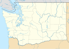
Yakima – miasto w Stanach Zjednoczonych, w stanie Waszyngton, nad rzeką Yakima. Według spisu w 2020 roku liczy 97 tys. mieszkańców i jest 11. co do wielkości miastem stanu Waszyngton[1]. Obszar metropolitalny obejmuje 256 tys. mieszkańców[2].
Znajduje się w Dolinie Yakimy, która jest uznawana za światową stolicę chmielu i odpowiada za większość produkcji chmielu w Stanach Zjednoczonych[3]. Jest także najstarszym uznanym regionem uprawy winorośli i produkcji wina w stanie Waszyngton[4].
W mieście rozwinął się przemysł spożywczy[5].
Demografia
Według danych pięcioletnich z 2020 roku do największych grup w obszarze metropolitalnym Yakimy należą osoby pochodzenia[6]:
- meksykańskiego (47,6%),
- niemieckiego (10,4%),
- angielskiego (5,6%),
- irlandzkiego (5,4%) i
- „amerykańskiego” (3,6%).
Religia
Według danych z 2010 roku do największych grup religijnych aglomeracji Yakimy należały:
- Kościół katolicki – 59,5 tys. członków w 16 kościołach,
- Kościoły zielonoświątkowe – ponad 11 tys. członków w 64 zborach,
- Kościół Jezusa Chrystusa Świętych w Dniach Ostatnich (mormoni) – 8,2 tys. wyznawców w 17 świątyniach,
- lokalne bezdenominacyjne zbory ewangelikalne – 5,3 tys. członków w 23 zborach,
- Kościoły kalwińskie – ponad 4,5 tys. członków w 19 kościołach,
- Kościoły uświęceniowe – ponad 4 tys. członków w 26 zborach,
- Kościół Adwentystów Dnia Siódmego – 3,3 tys. członków w 16 zborach,
- Kościoły luterańskie – 3,2 tys. członków w 14 kościołach.
Miasta partnerskie
 Meksyk: Morelia
 Japonia: Itayanagi
 Rosja: Derbent
 Republika Chińska: Keelung
 Stany Zjednoczone: Burley, Idaho
Urodzeni w Yakimie
- Robert Lucas Jr. (ur. 1937) – profesor ekonomii, noblista[7]
- Kyle MacLachlan (ur. 1959) – aktor
- Sam Kinison (1953–1992) – komik i autor
- Janet Waldo (1919–2016) – aktorka głosowa
- Barbara La Marr (1896–1926) – aktorka filmowa
Przypisy
- ↑ U.S. Census Bureau QuickFacts: Yakima city, Washington, www.census.gov [dostęp 2022-11-24] (ang.).
- ↑ Census profile: Yakima, WA Metro Area, Census Reporter [dostęp 2022-11-24] (ang.).
- ↑ Seattle Mag, The Hops Capital of the World is in Eastern Washington, Seattle magazine, 8 lipca 2022 [dostęp 2022-11-24] (ang.).
- ↑ Your guide to Yakima Valley wine country, Great Northwest Wine [dostęp 2022-11-24] (ang.).
- ↑ Yakima, [w:] Encyklopedia PWN [online] [dostęp 2021-08-29].
- ↑ 2020: ACS 5-Year Estimates Data Profiles (DP05/DP02), data.census.gov [dostęp 2022-11-24].
- ↑ Famous People From Yakima, Washington - #1 is Robert Lucas, Jr., Playback.fm [dostęp 2022-11-24] (ang.).
Media użyte na tej stronie
Autor: Uwe Dedering, Licencja: CC BY-SA 3.0
Location map of the USA (without Hawaii and Alaska).
EquiDistantConicProjection:
Central parallel:
* N: 37.0° N
Central meridian:
* E: 96.0° W
Standard parallels:
* 1: 32.0° N
* 2: 42.0° N
Made with Natural Earth. Free vector and raster map data @ naturalearthdata.com.
Formulas for x and y:
x = 50.0 + 124.03149777329222 * ((1.9694462586094064-({{{2}}}* pi / 180))
      * sin(0.6010514667026994 * ({{{3}}} + 96) * pi / 180))
y = 50.0 + 1.6155950752393982 * 124.03149777329222 * 0.02613325650382181
      - 1.6155950752393982  * 124.03149777329222 *
     (1.3236744353715044  - (1.9694462586094064-({{{2}}}* pi / 180))
      * cos(0.6010514667026994 * ({{{3}}} + 96) * pi / 180))
The flag of Navassa Island is simply the United States flag. It does not have a "local" flag or "unofficial" flag; it is an uninhabited island. The version with a profile view was based on Flags of the World and as a fictional design has no status warranting a place on any Wiki. It was made up by a random person with no connection to the island, it has never flown on the island, and it has never received any sort of recognition or validation by any authority. The person quoted on that page has no authority to bestow a flag, "unofficial" or otherwise, on the island.
Autor: Alexrk2, Licencja: CC BY 3.0
Ta mapa została stworzona za pomocą GeoTools.
Autor: Michael S. Shannon, Licencja: CC BY-SA 4.0
Yakima, Washington as seen from Lookout Point. 40th Ave looking south.


