Zabrzeg (Bieruń)
| ||||
| ||||
| Państwo | ||||
| Województwo | ||||
| Powiat | bieruńsko-lędziński | |||
| Miasto | Bieruń | |||
| W granicach Bierunia | 1991 | |||
| Tablice rejestracyjne | SBL | |||
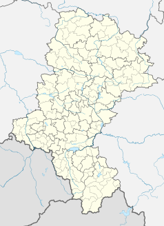
Położenie na mapie Polski (c) Karte: NordNordWest, Lizenz: Creative Commons by-sa-3.0 de | ||||
| Portal | ||||
W Zabrzegu występuje wyłącznie zabudowa domów jednorodzinnych. Przez dzielnicę przechodzi droga krajowa nr 44. Przez Zabrzeg przepływa Wisła.
| ||||||
Media użyte na tej stronie
Poland adm location map.svg
(c) Karte: NordNordWest, Lizenz: Creative Commons by-sa-3.0 de
Location map of Poland
(c) Karte: NordNordWest, Lizenz: Creative Commons by-sa-3.0 de
Location map of Poland
Silesian Voivodeship location map2.svg
Autor: SANtosito, Licencja: CC BY-SA 4.0
Location map of en:Silesian Voivodeship with counties (powiats) and municipalities (gminas). Geographic limits of the map:
Autor: SANtosito, Licencja: CC BY-SA 4.0
Location map of en:Silesian Voivodeship with counties (powiats) and municipalities (gminas). Geographic limits of the map:
- N: 51.1617 N
- S: 49.2956 N
- W: 17.8872 E
- E: 20.0559 E
Bieruń-Lędziny County location map02.svg
Autor: SANtosito, Licencja: CC BY-SA 4.0
Location map of Bieruń-Lędziny County with urbanized area highlighted. Geographic limits of the map:
Autor: SANtosito, Licencja: CC BY-SA 4.0
Location map of Bieruń-Lędziny County with urbanized area highlighted. Geographic limits of the map:
- N: 50.18 N
- S: 50.01 N
- W: 19.02 E
- E: 19.27 E


