Zapopan
 | |||||
| Państwo | |||||
|---|---|---|---|---|---|
| Stan | Jalisco | ||||
| Burmistrz | Juan Sánchez Aldana | ||||
| Powierzchnia | 187,69 km² | ||||
| Populacja (2014) • liczba ludności | 1 202,9 tys. | ||||
| Nr kierunkowy | +52 33 | ||||
| Kod pocztowy | 45010-45239 | ||||
| Strona internetowa | |||||
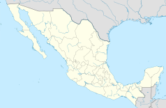
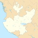
Zapopan – miasto w Meksyku, w stanie Jalisco, w aglomeracji Guadalajary, na północny zachód od tego miasta. Przez Zapopan płynie rzeka Río Atemajac[1]. W 2014 roku miasto liczyło 1 202,9 tysięcy mieszkańców.
W mieście rozwinął się przemysł elektroniczny, tytoniowy, mineralny oraz chemiczny[2].
Demografia
Źródło: City Population
Miasta partnerskie
Przypisy
- ↑ Zapopan. Google Maps. [dostęp 2016-05-14].
- ↑ Zapopan, [w:] Encyklopedia PWN [online] [dostęp 2021-08-29].
Media użyte na tej stronie
The flag of Navassa Island is simply the United States flag. It does not have a "local" flag or "unofficial" flag; it is an uninhabited island. The version with a profile view was based on Flags of the World and as a fictional design has no status warranting a place on any Wiki. It was made up by a random person with no connection to the island, it has never flown on the island, and it has never received any sort of recognition or validation by any authority. The person quoted on that page has no authority to bestow a flag, "unofficial" or otherwise, on the island.
Coat of arms of mexican minicipality of Zapopan, JAL.
Flag of mexican municipality of Zapopan, JAL.
Autor: Nheyob, Licencja: CC BY-SA 4.0
Templo De San Antonio Maria Claret (Zapopan, Jalisco) - exterior, view from Presidente Intercontinental
Location Map of Jalisco. EPSG:3857 projection, Geographic limits of the map:
- N: 23.00° N
- S: 18.60° N
- W: 106.00° W
- E: 101.20° W


