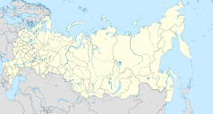
Zarubino (Kraj Nadmorski)
| Państwo | |
|---|---|
| Kraj | Nadmorski |
| Rejon | chasański |
| Populacja • liczba ludności | 2875 |
| Nr kierunkowy | 42331 |
| Kod pocztowy | 692725 |
| Portal | |
Zarubino (ros. Зарубино) – portowe osiedle typu miejskiego nad Zatoką Possieta, w Kraju Nadmorskim. Zostało założone 18 października 1928 roku.
Media użyte na tej stronie
Autor: Uwe Dedering, Licencja: CC BY-SA 3.0
Location map of Russia.
EquiDistantConicProjection : Central parallel :
* N: 54.0° N
Central meridian :
* E: 100.0° E
Standard parallels:
* 1: 49.0° N
* 2: 59.0° N
Made with Natural Earth. Free vector and raster map data @ naturalearthdata.com.
Because the southern Kuril islands are claimed by Russia and Japan, they are shown as disputed. For more information about this see: en:Kuril Islands dispute. These islands are since 1945 under the jurisdiction of the Russian Federation.
Autor: Das steinerne Herz, Licencja: CC BY-SA 3.0
Primorsky Krai location map


