Ziemia Północno-Wschodnia
 Zdjęcie satelitarne (NASA) | |
| Kontynent | Europa |
|---|---|
| Państwo | |
| Terytorium zależne | |
| Akwen | Ocean Arktyczny |
| Powierzchnia | 14 443 km² |
| Populacja • liczba ludności | 0 |
 | |
Ziemia Północno-Wschodnia (norw. Nordaustlandet) – niezamieszkana wyspa wchodząca w skład archipelagu Svalbard, położona na północny wschód od głównej wyspy Spitsbergen. Zajmuje powierzchnię 14 443 km² (druga pod względem wielkości po Spitsbergenie). Najwyższy punkt wyspy osiąga wysokość 764 m n.p.m.
Wnętrze wyspy – ponad 3/4 powierzchni (11 009 km²) pokrywają lodowce (Austfonna, Vestfonna i Sørfonna). Lodowiec Austfonna, zajmujący powierzchnię 8,2 tys. km², jest największym lodowcem Europy. Jego miąższość osiąga średnio 300 m, a maksymalnie nawet 560 m.
Wybrzeże wyspy to mroźne pustynie i częściowo tundra. Zamieszkują je renifery i morsy.
Media użyte na tej stronie
Autor: NordNordWest, Licencja: CC BY-SA 3.0
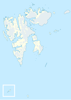
Location map of Svalbard, Norway
Autor: Jerzy Strzelecki, Licencja: CC BY-SA 3.0
Svalbard, Nordaustlandet, walruses colony
Map detailing the marine features of Spitsbergen in the Svalbard archipelago. Settlements and mountains are indicated and labelled. See also Image:Spitsbergen mountains and marine features labelled.png. Locations were labelled mainly based on detailed maps from svalbard-images.com (sample of south Spitsbergen linked), cross-referenced with other map sources where possible. Norwegian Polar Institute figures were used for mountain names and heights, which are given in meters above sea level.
Autor: Jerzy Strzelecki, Licencja: CC BY-SA 3.0
Svalbard, Nordaustlandet, walruses colony
Autor: Jerzy Strzelecki, Licencja: CC BY-SA 3.0
Svalbard, Nordaustlandet, Papaver dahlianum, Svalbard poppy, mak swalbardzki
Autor: Jerzy Strzelecki, Licencja: CC BY-SA 3.0
Svalbard, Nordaustlandet, Hinlopenstretet. Photo most probably taken from Gotiahalvøya over the Hinlopen strait towards Ny-Friesland (Lonfjorden), with Valhallfonna glacier to the right, Faksefjellet mountain in the center, and behind it to the left Myteberget and Sagnberget mountains.
Autor: The source file is from Uwe Dedering, Licencja: CC BY-SA 3.0
Relief location map of the Arctic Ocean.
- Projection: Azimuthal equidistant projection.
- Area of interest:
- N: 90.0° N
- S: 70.0° N
- W: -180.0° E
- E: 180.0° E
- Projection center:
- NS: 90° N
- WE: 0° E
Terra MODIS satellite image of Nordaustlandet, Svalbard


