Zoeterwoude
| Gmina | |||||
 Zdjęcie lotnicze gminy | |||||
| |||||
| Państwo | |||||
|---|---|---|---|---|---|
| Prowincja | |||||
| Siedziba | Zoeterwoude-Dorp | ||||
| Burmistrz | Liesbeth Bloemen (2014)[1] | ||||
| Powierzchnia | 21,96 km² | ||||
| Populacja (2013) • liczba ludności |
| ||||
| • gęstość | 380 os./km² | ||||
| Numer kierunkowy | 071 | ||||
| Kod pocztowy | 2381-2382 | ||||
| Plan | |||||
 | |||||
Położenie na mapie.svg) | |||||
| Strona internetowa | |||||
Zoeterwoude – gmina w zachodniej Holandii, w prowincji Holandia Południowa. Gmina ma powierzchnię 21,96 km² (z czego 0,7 km² to woda). Siedziba gminy znajduje się w Zoeterwoude-Dorp. W tej gminie znajduje się browar Heinekena.
Miejscowości gminy
Do gminy Zoeterwoude należą następujące miasta i wioski:
- Zoeterwoude-Dorp
- Zoeterwoude-Rijndijk
- Gelderswoude
- Weipoort
- Westeinde
- Zuidbuurt

Autostrada przebiegająca przez Zoeterwoude
Westeinde

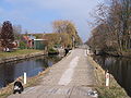
Kanał w Gelderswoude

Centrum Zoeterwoude-Dorp
Wiatrak w Zoeterwoude-Rijndijk
Bibliografia
Przypisy
- ↑ zoeterwoude.nl: Collegeleden (niderl.). [dostęp 2014-07-12]. [zarchiwizowane z tego adresu (2016-07-29)].
![]()
Media użyte na tej stronie


Flag of Zoeterwoude, in South Holland province, the Netherlands.
Autor: Janwillemvanaalst, Licencja: CC BY-SA 3.0
Topografische kaart van gemeente Zoeterwoude (2013).
Samengesteld door Jan-Willem van Aalst op basis van de GML open geodata van de BRT/Top10NL (basisregistratie Topografie, Kadaster 2011), vrijgegeven door Kadaster onder de Creative Commons BY licentie. Additionele gegevens uit BAG (8 juli 2013), uit de Open Street Map (9 juli 2013) en uit de Risicokaart. Peildatum kaartbeeld: 9 juli 2013. Zie ook Gemeentenatlas.nl
Samenstelling en kleurenschema: Jan-Willem van Aalst, met QuantumGIS en Photoshop. Zie ook de Legenda.


(c) Quistnix z niderlandzkiej Wikipedii, CC BY-SA 2.5
Zoeterwoude-Rijndijk: Grote Molen

Coat of arms of the Dutch municipality of Zoeterwoude.
Autor: Michiel1972 (talk) 23:12, 24 January 2009 (UTC), Licencja: CC BY-SA 3.0
- Location maps for the 441 municipalities in the Netherlands. Boundaries 1/1/2009
- Automatically generated with script
- File name contains "Municipality code" (CBS-code) as specified in: [1]
- Created in svg using coordinate data derived from ESRI data published by Centraal Bureau voor de Statistiek, Voorburg/Heerlen. ([2])
- Color coding and original design (slightly adpated by me) by user Mtcv (2006/2007) ([3])
 |
Właściciel autorskich praw majątkowych do tego pliku, Centraal Bureau voor de Statistiek, zezwala każdemu wykorzystać go w dowolnym celu, pod warunkiem, że wykorzystujący wyraźnie wskaże autora. Redystrybucja, wykonywanie prac pochodnych, użycie komercyjne oraz każde inne są dozwolone. |
|
Uznanie autorstwa: Centraal Bureau voor de Statistiek
|


Air photo of the dutch recreation park "Zoetermeerse Plas" in Zoetermeer.

Autor: M.Minderhoud, Licencja: CC-BY-SA-3.0
To jest zdjęcie holenderskiego zabytku (rijksmonument) numer 41035