1945-05-01GerWW2BattlefrontAtlas
Autor:
Army Map Service
Credit:
Document "Atlas of the World Battle Fronts in Semimonthly Phases to August 15th 1945: Supplement to The Biennial report of the Chief of Staff of the United States Army July 1, 1943 to June 30 1945 To the Secretary of War"
Krótki link:
źródło:
Wymiary:
1244 x 1215 Pixel (1962322 Bytes)
Opis:
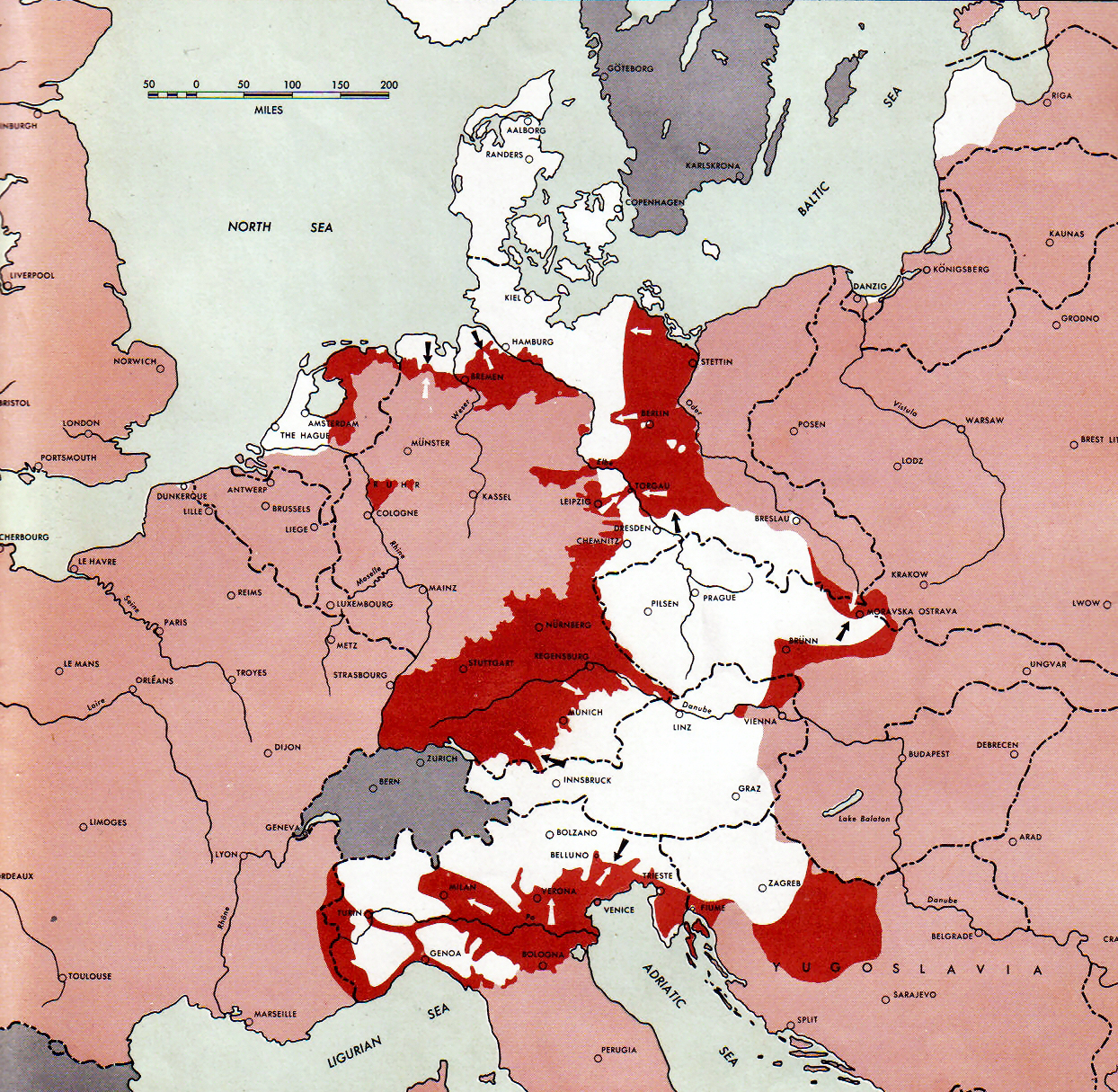
Neutral nations (Sweden, Switzerland, Spain, etc.)
Under Allied control
Allied forces
Axis forces
Map of the front against Germany: This map is taken from the source "Atlas of the World Battle Fronts in Semimonthly Phases to August 15th 1945: Supplement to The Biennial report of The Chief of Staff of the United States Army


July 1, 1943 to June 30 1945 To the Secretary of War". (See Cover, Forward and Map details)

Licencja:
Public domain
Komentarz do licencji:
Public Domain: Work of US army
Więcej informacji o licencji można znaleźć tutaj. Ostatnia aktualizacja: Fri, 30 Dec 2022 23:59:35 GMT