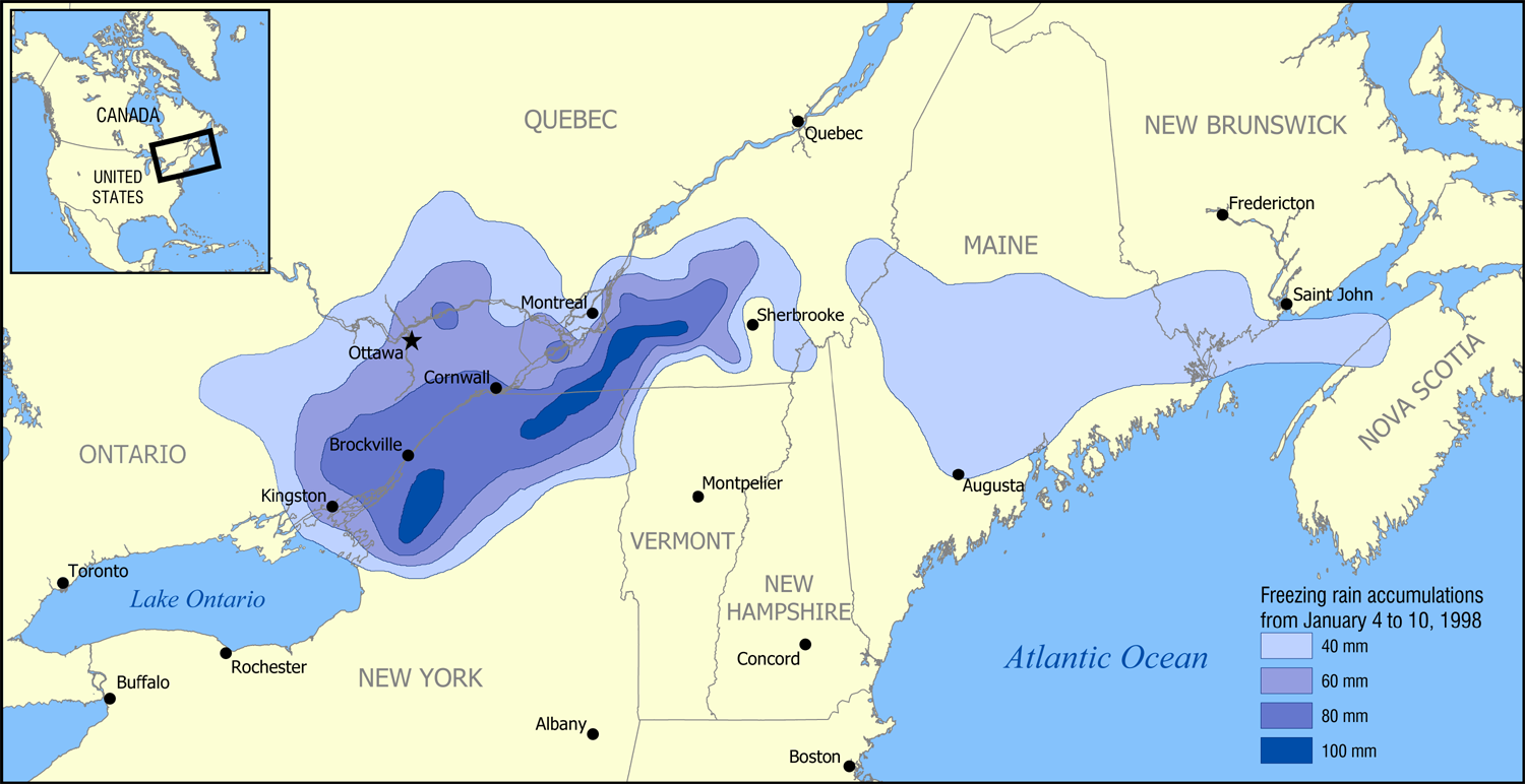
1998 Ice Storm map
Autor:
Attribution:
Obraz jest oznaczony jako „Wymagane uznanie autorstwa” (attribution required), ale nie podano żadnych informacji o uznaniu autorstwa. Prawdopodobnie parametr atrybucji został pominięty podczas korzystania z szablonu MediaWiki dla licencji CC-BY. Autorzy mogą znaleźć tutaj przykład prawidłowego korzystania z szablonów.
Credit:
Based on data from Environment Canada.
Krótki link:
źródło:
Wymiary:
1500 x 772 Pixel (531519 Bytes)
Opis:
A map showing the extent of the January 1998 North American ice storm that affected eastern Ontario, southwest Quebec, New Brunswick, and parts of New York, Vermont, New Hampshire, and Maine. The map shows the accumulation of ice in millimetres from January 4 to January 10, 1998. Increments shown are 40 mm (1.6 in), 60 mm (2.4 in), 80 mm (3.1 in), and 100 mm (3.9 in).
Licencja:
Warunki licencji:
Creative Commons Attribution-Share Alike 3.0
Więcej informacji o licencji można znaleźć tutaj. Ostatnia aktualizacja: Mon, 31 Oct 2022 19:00:58 GMT