AYool GLODAP del pH
Autor:
Attribution:
Obraz jest oznaczony jako „Wymagane uznanie autorstwa” (attribution required), ale nie podano żadnych informacji o uznaniu autorstwa. Prawdopodobnie parametr atrybucji został pominięty podczas korzystania z szablonu MediaWiki dla licencji CC-BY. Autorzy mogą znaleźć tutaj przykład prawidłowego korzystania z szablonów.
Credit:
English Wikipedia
Krótki link:
źródło:
Wymiary:
1683 x 1133 Pixel (237568 Bytes)
Opis:
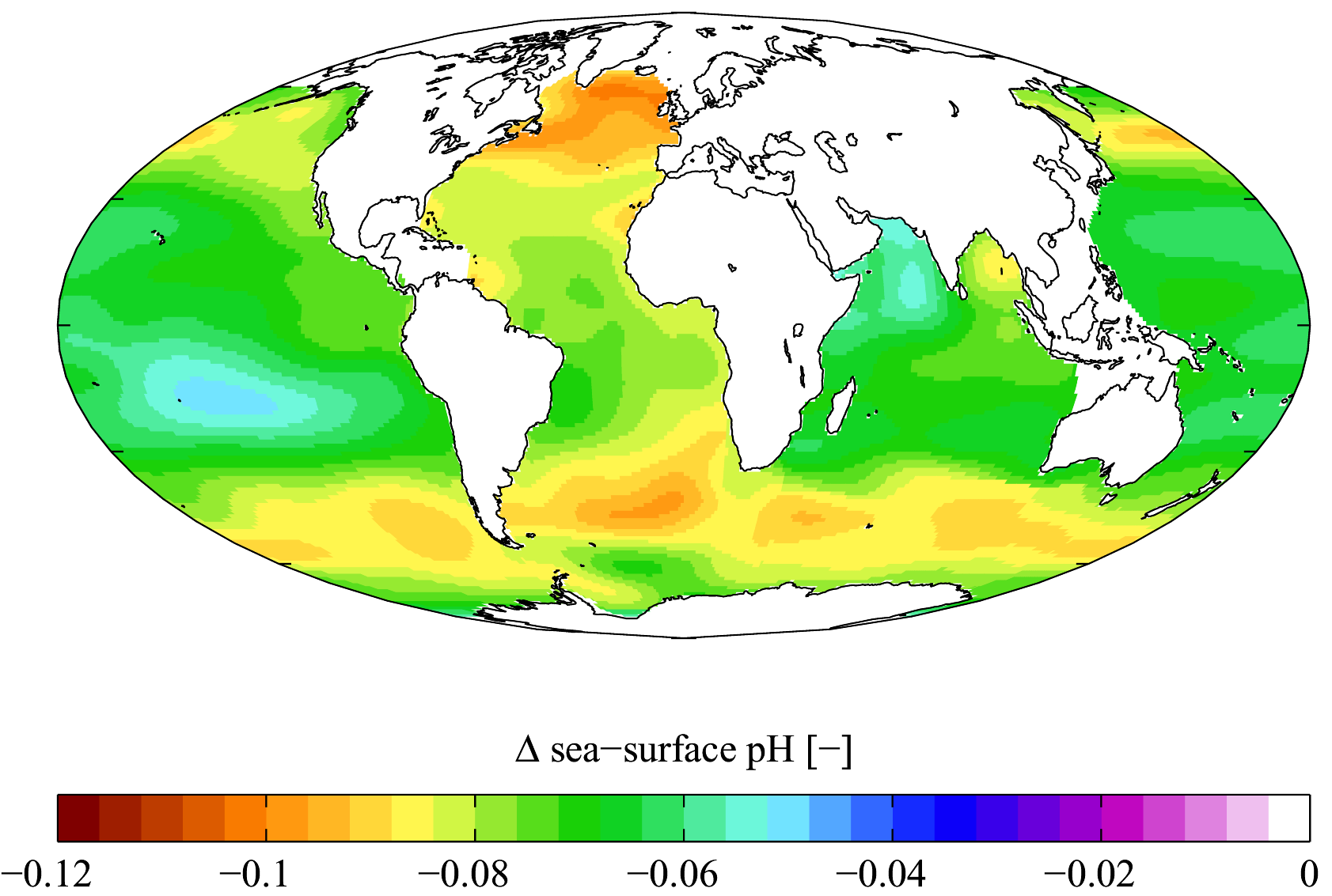
Estimated change in sea surface pH from the pre-industrial period (1700s) to the present day (1990s). Δ pH here is in standard pH units. This change is caused by the invasion of anthropogenic CO2 (see Ocean acidification). Calculated using Richard Zeebe's csys package with data from the Global Ocean Data Analysis Project[1][2] and World Ocean Atlas[3]climatologies. Δ pH is plotted here using a Mollweide projection (using MATLAB and the M_Map package).
Note that the GLODAP climatology is missing data in certain oceanic provinces including the Arctic Ocean, the Caribbean Sea, the Mediterranean Sea and the Malay Archipelago.
Licencja:
Warunki licencji:
Creative Commons Attribution 2.5
Więcej informacji o licencji można znaleźć tutaj. Ostatnia aktualizacja: Sun, 30 Oct 2022 09:31:51 GMT