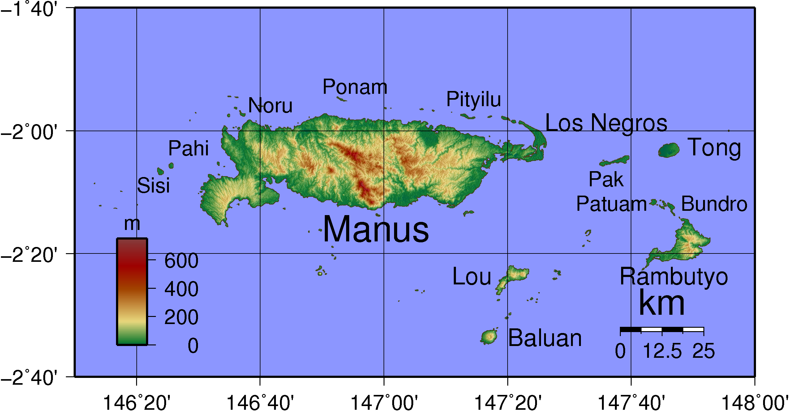
Admiralty Islands Topography with labels
Autor:
Credit:
Praca własna
Krótki link:
źródło:
Wymiary:
2554 x 1328 Pixel (577387 Bytes)
Opis:
Topographical map of Admiralty Island in Papua New Guinea. Largest islands have been named. Created with GMT from publicly released SRTM data.
Licencja:
Public domain
Więcej informacji o licencji można znaleźć tutaj. Ostatnia aktualizacja: Thu, 13 Oct 2022 03:36:23 GMT