Anglo.Saxon.migration.5th.cen
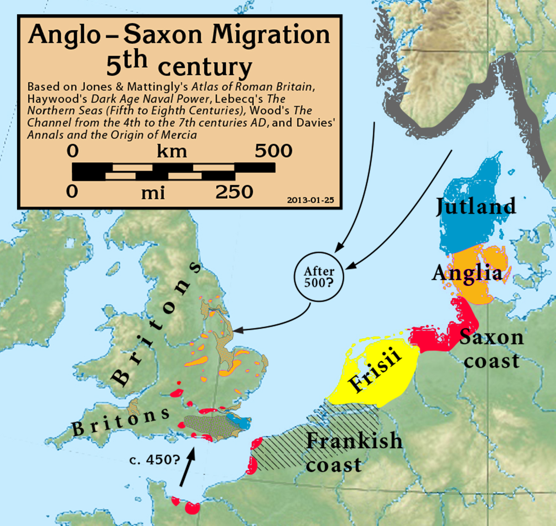
Based on Jones & Mattingly's Atlas of Roman Britain (ISBN 978-1-84217-06700, 1990, reprinted 2007, pp. 317, 318), Haywood's Dark Age Naval Power (ISBN 1-898281-43-2, 1999, cemeteries on pp. 84–86, 121, region of "Romanisation" on p. 151), Lebecq's The Northern Seas (fifth to eighth centuries) (in The New Cambridge Medieval History, Vol I c.500–c.700, ISBN 13-978-0-521-36291-7, 2005, p. 643), and Wood's The Channel from the 4th to the 7th centuries AD in Carver's Maritime Celts, Frisians and Saxons (ISBN 978-0906780930, pp 93–97). The suggestion that settlements in Britain were made from the Bessin is from Haywood (Vron, for example, was abandoned c. 450).
Jones & Mattingly also show 5th century cemeteries in the central English Midlands south of the River Trent, based on the dating of excavated cemeteries, but this is disputed by historians arguing for a 6th century Anglo-Saxon expansion into that region (see, for example Annals and the Origin of Mercia, pp. 20–24, by Wendy Davies, in Mercian Studies, 1977, ISBN 0718511484).
Więcej informacji o licencji można znaleźć tutaj. Ostatnia aktualizacja: Tue, 29 Nov 2022 09:20:42 GMT