Antarctica (4), Adelaide Island, Stonehouse Bay
Autor:
Vincent van Zeijst
Attribution:
Obraz jest oznaczony jako „Wymagane uznanie autorstwa” (attribution required), ale nie podano żadnych informacji o uznaniu autorstwa. Prawdopodobnie parametr atrybucji został pominięty podczas korzystania z szablonu MediaWiki dla licencji CC-BY. Autorzy mogą znaleźć tutaj przykład prawidłowego korzystania z szablonów.
Credit:
Praca własna
Krótki link:
źródło:
,_Adelaide_Island,_Stonehouse_Bay.JPG?uselang=pl)
Wymiary:
1716 x 1140 Pixel (460034 Bytes)
Opis:
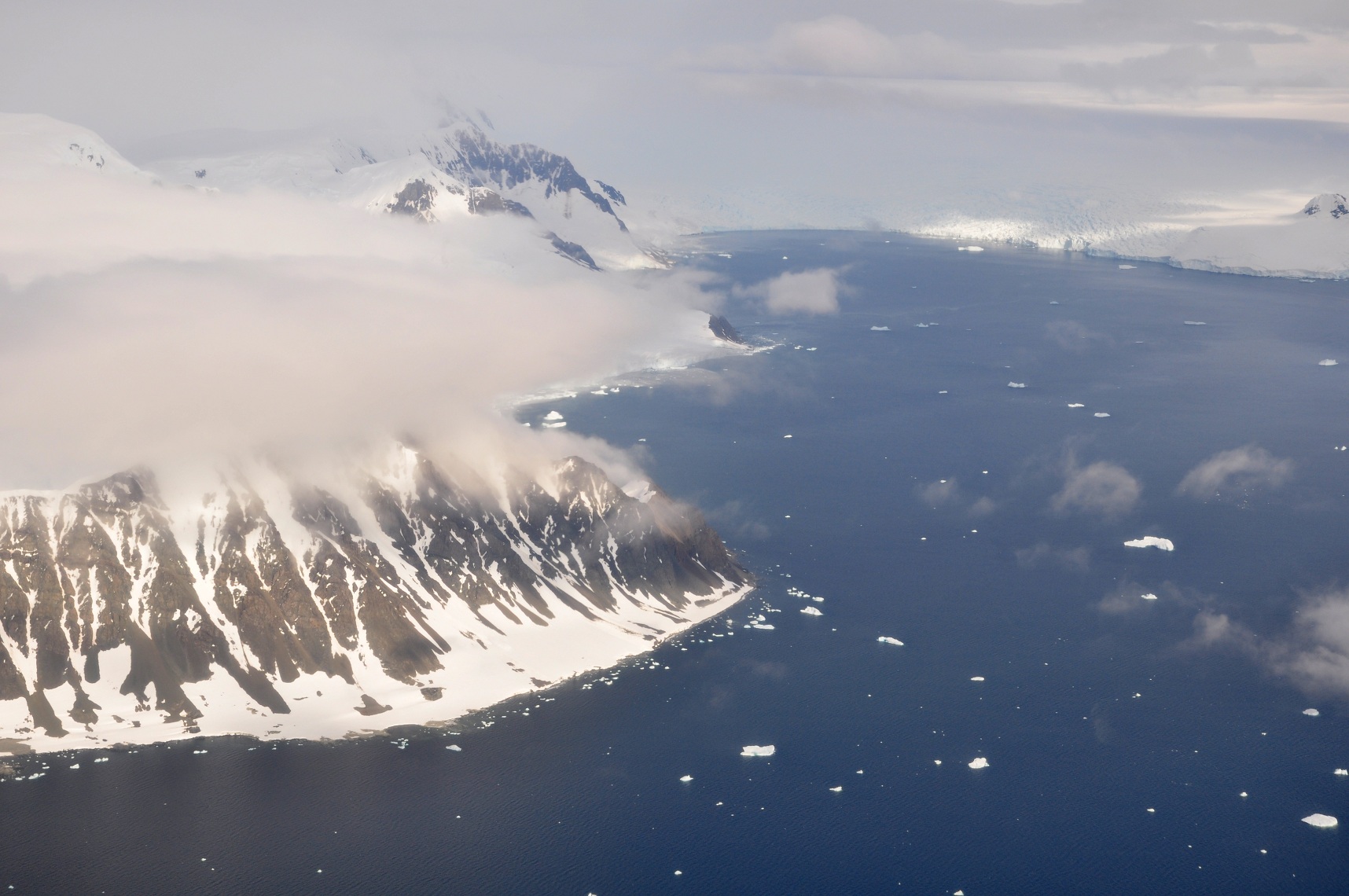
This picture is from the SW Antarctic Peninsula region.
It's an aerial view, looking West, from a position over Laubeuf Fjord to a part of Adelaide Island's east coast. In the foreground on the left is Sighing Peak, which forms the NE extremity of Adelaide Island's Wright Peninsula. The mountains behind it are the Stokes Peaks. The channel in front of Sighing Peak is called Cole Channel (and is actually a part of Laubeuf Fjord). The large body of water on the right is Stonehouse Bay. In the upper right hand corner of the picture, at the western end of Stonehouse Bay, is the huge and heavily crevassed Shambles Glacier; Adelaide Island's largest glacier. To the right of the glacier, at the extreme edge of the picture, is Dewar Nunatak.
Licencja:
Warunki licencji:
Creative Commons Attribution-Share Alike 3.0
Więcej informacji o licencji można znaleźć tutaj. Ostatnia aktualizacja: Thu, 06 May 2021 23:38:50 GMT