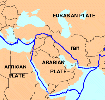
Arabian tectonic plate overview map
Autor:
U.S. Geological Survey
Credit:
http://neic.usgs.gov/neis/gifs/iran_plates.gif
Used in document: http://neic.usgs.gov/neis/eq_depot/2004/eq_040528/neic_jaan_ts.html
- Tectonic Summary Magnitude 6.3 NORTHERN IRAN 2004 May 28 12:38:46 UTC
Krótki link:
źródło:
Wymiary:
213 x 203 Pixel (19180 Bytes)
Opis:
Overview map of the Arabian tectonic plate.
Licencja:
Public domain
Więcej informacji o licencji można znaleźć tutaj. Ostatnia aktualizacja: Sat, 29 Oct 2022 04:51:27 GMT