Argo navis constellation map
Autor:
Attribution:
Obraz jest oznaczony jako „Wymagane uznanie autorstwa” (attribution required), ale nie podano żadnych informacji o uznaniu autorstwa. Prawdopodobnie parametr atrybucji został pominięty podczas korzystania z szablonu MediaWiki dla licencji CC-BY. Autorzy mogą znaleźć tutaj przykład prawidłowego korzystania z szablonów.
Credit:
Praca własna
Krótki link:
źródło:
Wymiary:
2216 x 2753 Pixel (937594 Bytes)
Opis:
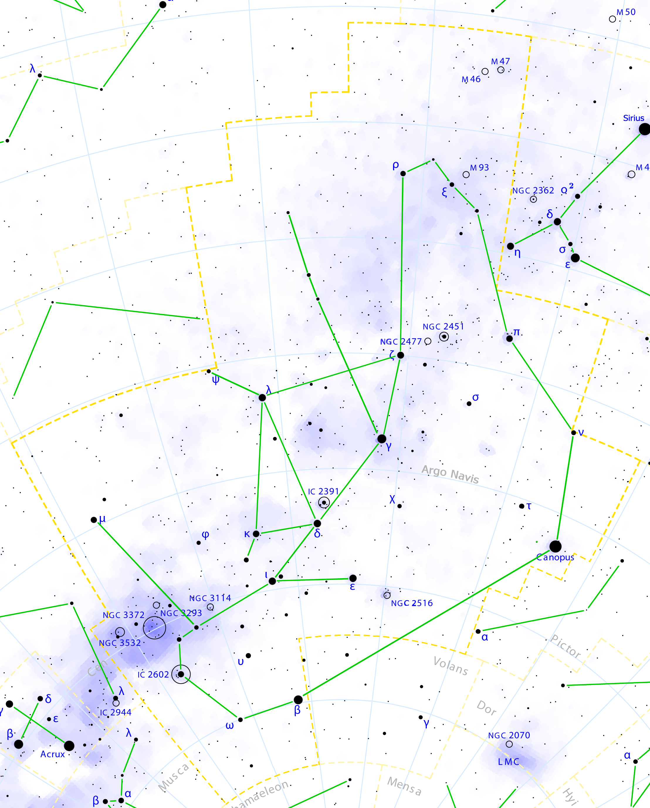
This is a celestial map of the ancient constellation Argo Navis, the Argo's Ship, as seen if Lacaille didn't divide it into Puppis, Vela, Carina and Pyxis.
LMC is the Large Magellanic Cloud.
It was created by Torsten Bronger using the program PP3 on 2000/07/07. At PP3's homepage, you also get the input scripts necessary for re-compiling the map.
The yellow dashed lines are constellation boundaries, the red dashed line is the ecliptic, and the shades of blue show Milky Way areas of different brightness. The map contains all Messier objects, except for colliding ones. The underlying database contains all stars brighter than 6.5. All coordinates refer to equinox 2000.0.
The map is calculated with the equidistant azimuthal projection (the zenith being in the center of the image). The north pole is to the top. The (horizontal) lines of equal declination are drawn for 0°, ±10°, ±20° etc. The lines of equal rectascension are drawn for all 24 hours. Towards the rim there is a very slight magnification (and distortion).
Licencja:
Komentarz do licencji:
GFDL/FAL
Warunki licencji:
Creative Commons Attribution-Share Alike 3.0
Więcej informacji o licencji można znaleźć tutaj. Ostatnia aktualizacja: Tue, 30 Mar 2021 13:52:06 GMT