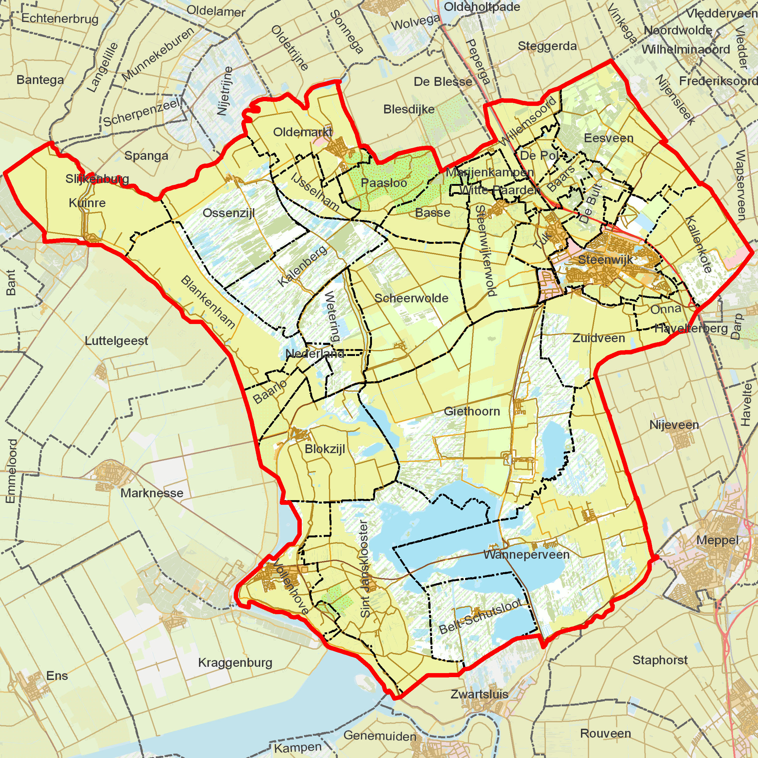
BAG woonplaatsen - Gemeente Steenwijkerland
Autor:
|
Map data (c) OpenStreetMap contributors, CC-BY-SA • Shape files infrastructure and nature (railway, roads, water, forest): all originally by OpenStreetMap contributors. Status december 2011 |
Attribution:
Obraz jest oznaczony jako „Wymagane uznanie autorstwa” (attribution required), ale nie podano żadnych informacji o uznaniu autorstwa. Prawdopodobnie parametr atrybucji został pominięty podczas korzystania z szablonu MediaWiki dla licencji CC-BY. Autorzy mogą znaleźć tutaj przykład prawidłowego korzystania z szablonów.
Credit:
derived work, see author
Krótki link:
źródło:
Wymiary:
2419 x 2419 Pixel (1368050 Bytes)
Opis:
BAG woonplaatsen - Gemeente Steenwijkerland.png
Licencja:
Warunki licencji:
Creative Commons Attribution 2.0
Więcej informacji o licencji można znaleźć tutaj. Ostatnia aktualizacja: Sun, 09 Oct 2022 04:23:54 GMT