BlueLine
Autor:
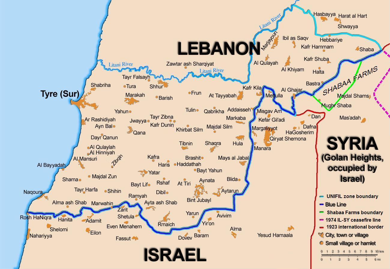
99of9 / * The map is made by Thomas Blomberg using the UNIFIL map, deployment as of July 2006 as source.
Attribution:
Obraz jest oznaczony jako „Wymagane uznanie autorstwa” (attribution required), ale nie podano żadnych informacji o uznaniu autorstwa. Prawdopodobnie parametr atrybucji został pominięty podczas korzystania z szablonu MediaWiki dla licencji CC-BY. Autorzy mogą znaleźć tutaj przykład prawidłowego korzystania z szablonów.
Credit:
Self-published work by 99of9
Krótki link:
źródło:
Wymiary:
1299 x 898 Pixel (161102 Bytes)
Opis:
Map showing the Blue Line demarcation line between Lebanon and Israel, established by the UN after the Israeli withdrawal from southern Lebanon after its short 1978 invasion called Operation Litani. It follows the 1949 cease-fire line, also known as the Green Line, as well as the somewhat contested Lebanese-Syrian border towards the Israeli-occupied Golan Heights.
Licencja:
Warunki licencji:
Creative Commons Attribution-Share Alike 2.5
Więcej informacji o licencji można znaleźć tutaj. Ostatnia aktualizacja: Tue, 27 Dec 2022 09:47:36 GMT