ChimborazoTungurahua ETM 20010916
Autor:
Jesse Allen, NASA Earth Observatory, based on data provided by the Landsat 7 science team and the University of Maryland’s Global Land Cover Facility.
Krótki link:
źródło:
Wymiary:
2400 x 2400 Pixel (3088578 Bytes)
Opis:
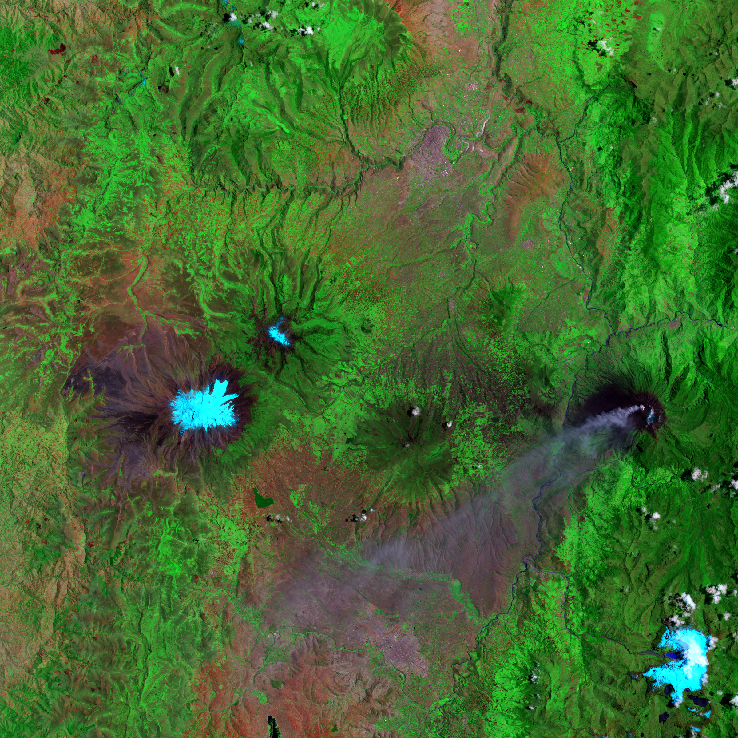
False-color satellite image of Chimborazo (center, left), Carihuairazo (10km northeast of Chimborazo), Tungurahua (center, right with ash plume) and El Altar (bottom, right), Ecuador. Pale blue indicates snow/ice cover, bright green indicates lush vegetation, and red indicates sparser vegetation. Tungurahua’s volcanic ash plume appears in lavender. Image width is 78km, image direction is top to North
Licencja:
Public domain
Komentarz do licencji:
US government, public domain
Więcej informacji o licencji można znaleźć tutaj. Ostatnia aktualizacja: Mon, 14 Nov 2022 11:25:24 GMT