Congress Poland map 19th century
![[1]](http://wojtek.onlinesc.net/bebelno/grafika/bebelno_mapa_polski_ii_pol_xix_w.jpg)
Krótki link:
źródło:
Wymiary:
1275 x 1526 Pixel (1440823 Bytes)
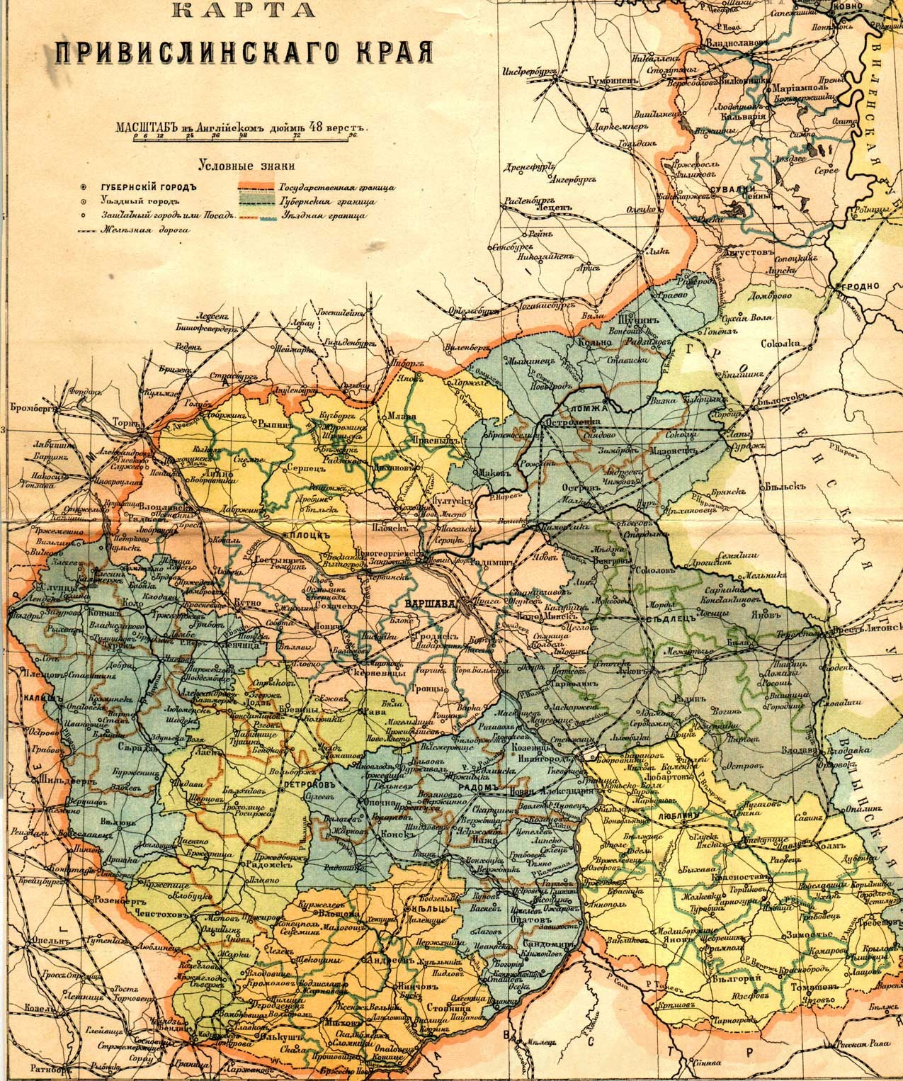
Opis:
Russian map of Vistula land (Privislinsky Krai, former Congress Poland), approx. second half of the 19th century. The scale of the map is 48 versts per English inch. Left column of the legend:
- Governorate-level town
- Uyezd (district)-level town
- Non-uyezd towns (those which had town status but did not serve as uyezd seats)/posad
- Railroad
Right column:
- State border
- Governorate border
- Uyezd border
Licencja:
Public domain
Komentarz do licencji:
Public Domain due to age
Więcej informacji o licencji można znaleźć tutaj. Ostatnia aktualizacja: Wed, 30 Nov 2022 05:56:42 GMT