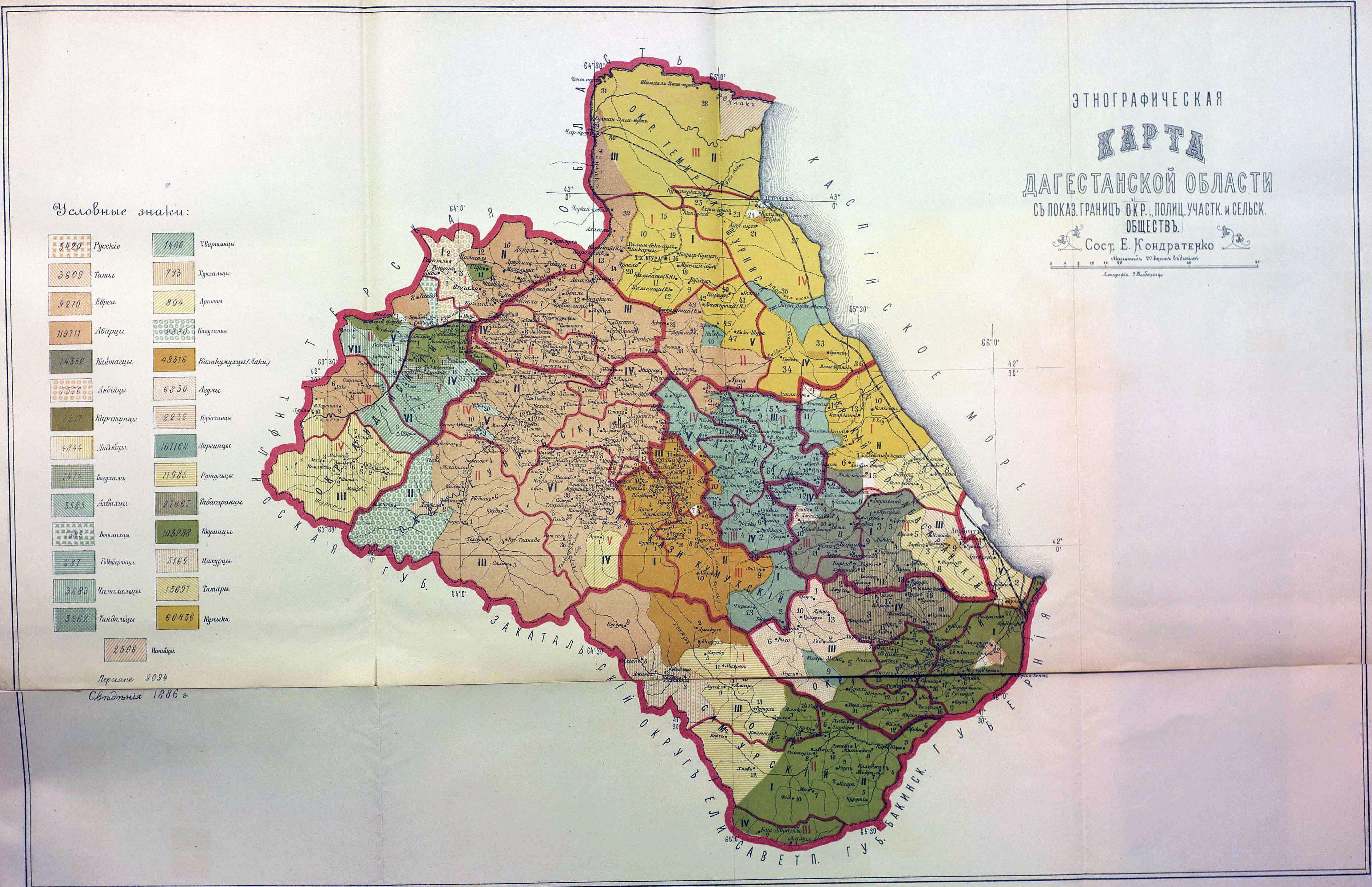
Daghestan ethnographic and administrative map 1886
Autor:
E. Kondratenko
Credit:
Krótki link:
źródło:
Wymiary:
4105 x 2655 Pixel (2168707 Bytes)
Opis:
Daghestan ethnographic map with the boroughs, police districts, rural communities limits shown. Compiled by E. Kondratenko. Scale 20 versta per inch. Data from 1886.
Licencja:
Public domain
Więcej informacji o licencji można znaleźć tutaj. Ostatnia aktualizacja: Sun, 09 May 2021 00:31:06 GMT