Diakopto-Kalavrita-Chelmos-Landsat7 WW texted
Autor:
Fotografia: NASA
Credit:
installed WW-Software needed: worldwind://goto/world=Earth&lat=38.05234&lon=22.18076&alt=20000&dir=180&tilt=60
Krótki link:
źródło:
Wymiary:
1600 x 1162 Pixel (2101715 Bytes)
Opis:
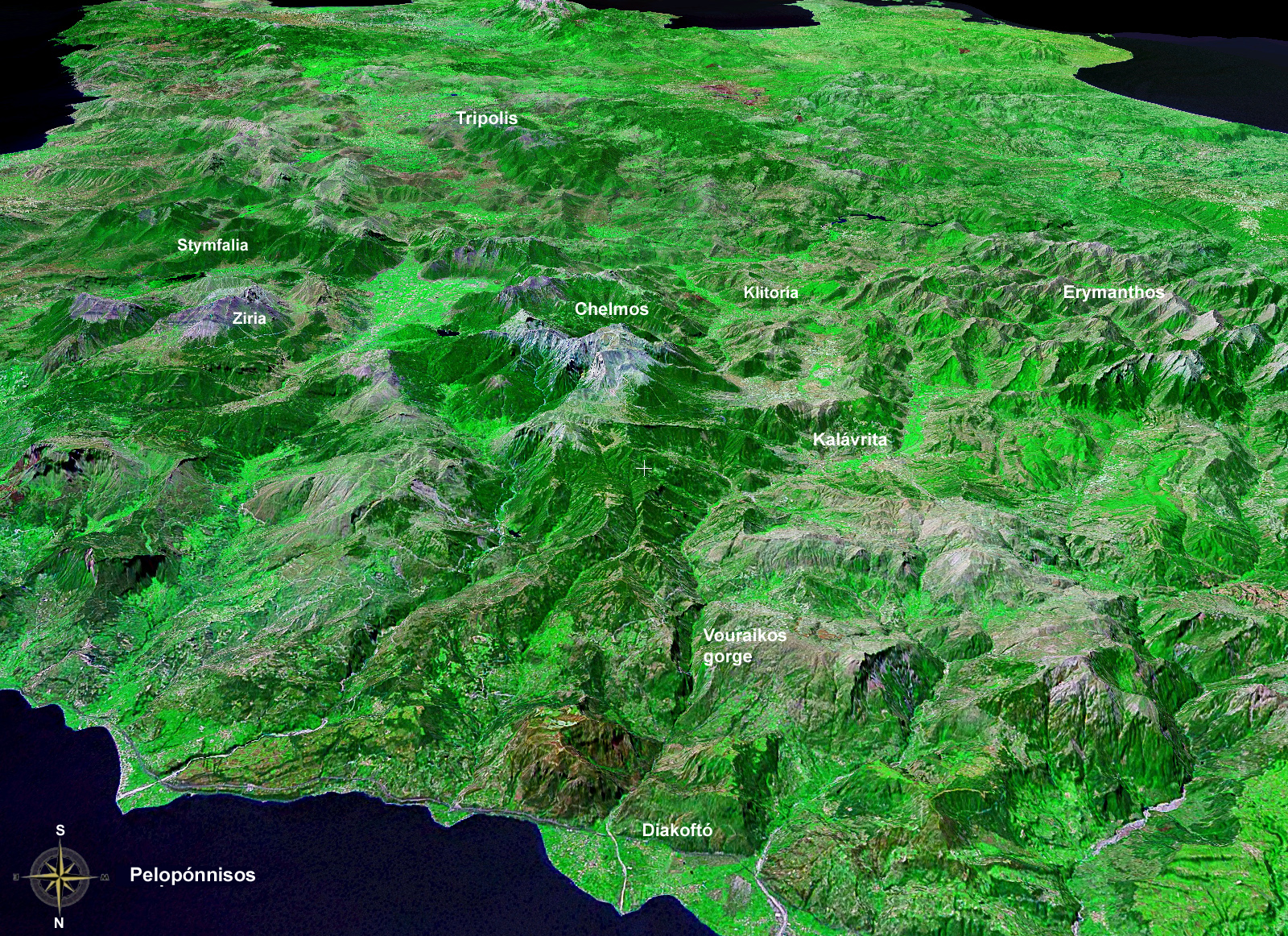
Peloponnese, north==>south, altitude: 20 km; Landsat7, GeoCover 2000, res. 15m/pix
Vorne: Golf von Korinth; Schwemmkegel des Flusses Vouraikos bei Diakoptó. Das nach Kalavrita beginnende Gefälle des Flusses schuf die Schlucht. Das Hochtal im Hintergrund (südöstlich Kalavrita) sammelt das Oberflächenwasser der umliegenden Berge.
Licencja:
Public domain
Więcej informacji o licencji można znaleźć tutaj. Ostatnia aktualizacja: Thu, 29 Dec 2022 06:27:30 GMT