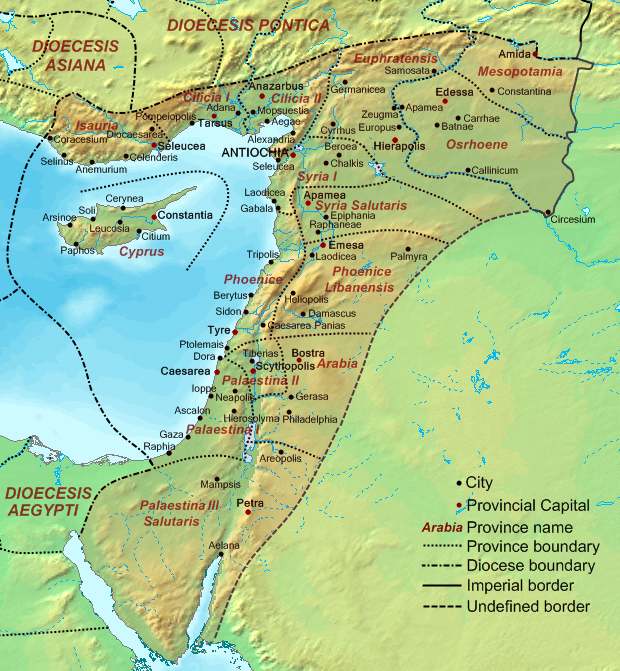
Dioecesis Orientis 400 AD
Autor:
Credit:
Base map found at en:Topographic map#Global 1-kilometer map, otherwise self-made. Data based on maps in atlases and the internet and on contemporary sources, primarily the Notitia Dignitatum and the Synecdemus.
Note: the exact course of the provincial boundaries is very uncertain and in many cases only approximate.
Note: the exact course of the provincial boundaries is very uncertain and in many cases only approximate.
Krótki link:
źródło:
Wymiary:
620 x 671 Pixel (381606 Bytes)
Opis:
Map of the Diocese of the East (Dioecesis Orientis) ca. 400 AD, showing the subordinate provinces and the major cities.
Licencja:
Public domain
Więcej informacji o licencji można znaleźć tutaj. Ostatnia aktualizacja: Thu, 05 Jan 2023 17:51:28 GMT
